Clarktown, Ohio
Clarktown, Ohio | |
|---|---|
 Baptist church on State Route 139 | |
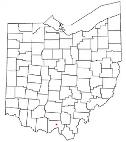 Location of Clarktown, Ohio | |
| Coordinates: 38°50′59″N 82°54′31″W / 38.84972°N 82.90861°W | |
| Country | United States |
| State | Ohio |
| County | Scioto |
| Township | Jefferson |
| Elevation | 666 ft (203 m) |
| Population | |
• Total | 911 |
| Time zone | UTC-5 (Eastern (EST)) |
| • Summer (DST) | UTC-4 (EDT) |
| Area codes | 740, 220 |
| GNIS feature ID | 2633226[1] |
Clarktown is an unincorporated community and census-designated place in southeastern Jefferson Township, Scioto County, Ohio, United States. As of the 2020 census it had a population of 911.
Geography
Located at the intersection of State Route 139 with Burns Hollow and Blue Run roads, it lies 5 miles (8 km) southeast of Lucasville and 10 miles (16 km) northeast of the city of Portsmouth, the county seat of Scioto County. Long Run, a tributary of the Rocky Fork of the Little Scioto River, flows past the community.[3]
References
- ^ a b U.S. Geological Survey Geographic Names Information System: Clarktown, Ohio
- ^ "Clarktown CPD, Ohio - Census Bureau Profile". United States Census Bureau. Retrieved August 19, 2023.
- ^ DeLorme. Ohio Atlas & Gazetteer. 7th ed. Yarmouth: DeLorme, 2004, p. 85. ISBN 0-89933-281-1.
Municipalities and communities of Scioto County, Ohio, United States | ||
|---|---|---|
| City |  | |
| Villages | ||
| Townships | ||
| CDPs | ||
| Unincorporated communities | ||
| Footnotes | ‡This populated place also has portions in an adjacent county or counties | |