Clearfield, Kansas
Clearfield, Kansas | |
|---|---|
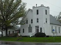 Clearfield United Methodist Church (2011) | |
 KDOT map of Douglas County (legend) | |
 Clearfield  Clearfield | |
| Coordinates: 38°49′34″N 95°05′37″W / 38.82611°N 95.09361°W[1] | |
| Country | United States |
| State | Kansas |
| County | Douglas |
| Elevation | 1,001 ft (305 m) |
| Time zone | UTC-6 (CST) |
| • Summer (DST) | UTC-5 (CDT) |
| Area code | 785 |
| FIPS code | 20-13850 [1] |
| GNIS ID | 484894 [1] |
Clearfield is an unincorporated community in Douglas County, Kansas, United States,[1] and is located northeast of Baldwin City at the intersection of E 2200 and N 600 roads.
History
A post office was opened in Clearfield in 1885, and remained in operation until it was discontinued in 1900.[2]
References
- ^ a b c d e "Clearfield, Kansas", Geographic Names Information System, United States Geological Survey, United States Department of the Interior
- ^ "Kansas Post Offices, 1828-1961 (archived)". Kansas Historical Society. Archived from the original on March 10, 2013. Retrieved June 8, 2014.
Further reading
External links
Municipalities and communities of Douglas County, Kansas, United States | ||
|---|---|---|
| Cities |  | |
| Unincorporated communities | ||
| Ghost towns | ||
| Townships | ||