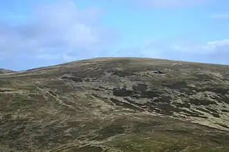
Cramalt Craig
| Cramalt Craig | |
|---|---|
 Cramalt Craig | |
| Highest point | |
| Elevation | 830.2 m (2,724 ft)[1] |
| Prominence | 147.4 m (484 ft)[1] |
| Listing | Hu,Tu,Sim,D,sMa,CT,DN,Y,xC[2] |
| Geography | |
| Location | Scottish Borders, Scotland |
| Parent range | Manor Hills, Southern Uplands |
| OS grid | NT 16846 24736 |
| Topo map | OS Landranger 72 |
Cramalt Craig is a hill in the Manor Hills range, part of the Southern Uplands of Scotland. The second highest in the range and third highest in southern Scotland, it was previously also a Corbett until new Ordnance Survey contouring became available and it was deleted from the 1984 edition of the tables[3]. A 2013 survey by Alan Dawson confirmed the col between it and Broad Law to be a few metres short of 500 feet (152.4 metres).[1] It is climbed almost solely from its southern sides at the Megget Stane or Cramalt Farm, taking in the neighbouring hills.
Subsidiary SMC Summits
| Summit | Height (m) | Listing[2] |
|---|---|---|
| Clockmore | 641 | Tu,Sim,DT,GT,DN[4] |
| Hunt Law | 639 | Tu,Sim,DT,GT,DN[5] |
References
- ^ a b c "Mountain Search - Cramalt Craig". www.hill-bagging.co.uk.
- ^ a b "Database of British and Irish Hills: user guide". www.hills-database.co.uk.
- ^ "Corbetts 1923-2016". www.hills-database.co.uk.
- ^ "Mountain Search - Clockmore". www.hill-bagging.co.uk.
- ^ "Mountain Search - Hunt Law". www.hill-bagging.co.uk.