Districts and neighbourhoods of Dalfsen
The Dutch municipality Dalfsen is divided into districts and neighbourhoods for statistical purposes. The municipality is divided into the following statistical districts:
- District 00 Dalfsen (kern) (CBS-neighbourhood code:014800)
- District 01 Dalfsen - buitengebied (CBS-neighbourhood code:014801)
- District 02 Oudleusen (CBS-neighbourhood code:014802)
- District 03 Hoonhorst (CBS-neighbourhood code:014803)
- District 04 Lenthe-2 (CBS-neighbourhood code:014804)
- District 05 Kluinhaar (CBS-neighbourhood code:014805)
- District 06 Lemelerveld (CBS-neighbourhood code:014806)
- District 07 Leusenerveld (CBS-neighbourhood code:014807)
A statistical district may consist of several neighbourhoods. The table below shows the neighbourhood division with characteristic values according to the Statistics Netherlands (CBS, 2008):[1]
| CBS-neighbourhood code | Neighbourhood name | Population | Area total (ha) | Area land (ha) | Position |
|---|---|---|---|---|---|
| BU01480000 | Dalfsen-Kom | 450 | 20 | 18 | _-_Buurt_00_Dalfsen-Kom.svg.png)
|
| BU01480001 | Dalfsen-Vechtvliet | 370 | 38 | 35 | _-_Buurt_01_Dalfsen-Vechtvliet.svg.png)
|
| BU01480002 | Dalfsen-Rondweg | 280 | 60 | 57 | _-_Buurt_02_Dalfsen-Rondweg.svg.png)
|
| BU01480003 | Dalfsen-Pleijendal | 1320 | 27 | 27 | _-_Buurt_03_Dalfsen-Pleijendal.svg.png)
|
| BU01480004 | Dalfsen-Leemcule | 470 | 22 | 22 | _-_Buurt_04_Dalfsen-Leemcule.svg.png)
|
| BU01480005 | Dalfsen-Polhaar-Oost | 1300 | 27 | 27 | _-_Buurt_05_Dalfsen-Polhaar-Oost.svg.png)
|
| BU01480006 | Dalfsen-Polhaar-West | 1080 | 24 | 24 | _-_Buurt_06_Dalfsen-Polhaar-West.svg.png)
|
| BU01480007 | Dalfsen-Ankummer-Es I | 1120 | 23 | 23 | _-_Buurt_07_Dalfsen-Ankummer-Es_I.svg.png)
|
| BU01480008 | Dalfsen-Ankummer-Es II | 1320 | 27 | 27 | _-_Buurt_08_Dalfsen-Ankummer-Es_II.svg.png)
|
| BU01480100 | Ankum-Kern | 100 | 8 | 8 | 
|
| BU01480104 | Verspreide huizen Ankum | 620 | 1008 | 995 | 
|
| BU01480105 | Verspreide huizen Dalfserveld | 350 | 1577 | 1577 | 
|
| BU01480106 | Verspreide huizen Gerner-Welsum | 910 | 630 | 620 | 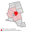
|
| BU01480107 | Verspreide huizen Rechteren-Hessum | 450 | 1447 | 1433 | 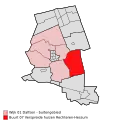
|
| BU01480108 | Verspreide huizen Milligen | 240 | 1285 | 1274 | 
|
| BU01480109 | Verspreide huizen Emmen-De Marshoek | 380 | 1095 | 1069 | 
|
| BU01480200 | Oudleusen kern | 400 | 15 | 15 | 
|
| BU01480209 | Verspreide huizen Oudleusenerveld | 810 | 1347 | 1337 | 
|
| BU01480300 | Hoonhorst kern | 620 | 44 | 44 | 
|
| BU01480309 | Verspreide huizen Lenthe | 480 | 992 | 990 | 
|
| BU01480409 | Verspreide huizen Lenthe-2 | 80 | 199 | 196 | 
|
| BU01480509 | Verspreide huizen Kluinhaar | 0 | 112 | 110 | 
|
| BU01480600 | Lemelerveld kern | 3140 | 200 | 195 | 
|
| BU01480606 | Miga, 't Zwarte, Koelen, Schanebroek 1 | 330 | 542 | 540 | 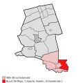
|
| BU01480607 | Schanebroek 2 en Wolthaarshoek | 160 | 295 | 293 | 
|
| BU01480608 | Verspreide huizen Strenkhaar | 430 | 622 | 619 | 
|
| BU01480609 | Verspreide huizen Dalmsholte | 470 | 1186 | 1179 | 
|
| BU01480700 | Nieuwleusen-Zuid | 2790 | 251 | 251 | 
|
| BU01480701 | Nieuwleusen-Noord | 3060 | 181 | 171 | 
|
| BU01480705 | Verspreide huizen Nieuwleusen-Zuid (gedeeltelijk) | 1150 | 516 | 514 | .svg.png)
|
| BU01480706 | Verspreide huizen Nieuwleusen-Noord (gedeeltelijk) | 440 | 398 | 397 | .svg.png)
|
| BU01480707 | Verspreide huizen Ruitenveen | 490 | 819 | 818 | 
|
| BU01480708 | Verspreide huizen De Meele | 620 | 634 | 628 | 
|
| BU01480709 | Veenekampen-De Ruiten | 490 | 982 | 981 | 
|
References
- ^ "Centraal Bureau voor de Statistiek". Digitale publicatie wijk- en buurtkaart, 2008. 6 June 2015. Archived from the original on 20 May 2015. Retrieved 6 June 2015.