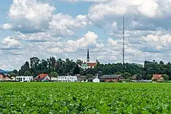
Dobl
Dobl | |
|---|---|
 | |
 Coat of arms | |
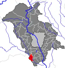 Location within Graz-Umgebung district | |
 Dobl Location within Austria | |
| Coordinates: 46°56′48″N 15°22′35″E / 46.94667°N 15.37639°E | |
| Country | Austria |
| State | Styria |
| District | Graz-Umgebung |
| Area | |
• Total | 13.76 km2 (5.31 sq mi) |
| Elevation | 362 m (1,188 ft) |
| Population (2014-01-01) | |
• Total | 1,805 |
| • Density | 130/km2 (340/sq mi) |
| Time zone | UTC+1 (CET) |
| • Summer (DST) | UTC+2 (CEST) |
| Postal code | 8143 |
| Area code | 03136 |
| Vehicle registration | GU |
| Website | www.dobl.at |
Dobl was a municipality in Austria which merged in January 2015 into Dobl-Zwaring in the Graz-Umgebung District of Styria, Austria.[1]
Geography
Dobl is located in the Kaiser forest in the valley of the Kainach River, about 14 km (8.7 mi) southwest of Graz.
References
- ^ Steiermärkisches Gemeindestrukturreformgesetz – StGsrG, Landesgesetzblatt des Landes Steiermark. Nr. 31/2014 (Styria State Official Gazette, in German).