Doliani
Doliani
Δόλιανη Doljani | |
|---|---|
 | |
 Doliani | |
| Coordinates: 39°49.3′N 20°57.1′E / 39.8217°N 20.9517°E | |
| Country | Greece |
| Administrative region | Epirus |
| Regional unit | Ioannina |
| Municipality | Zagori |
| Municipal unit | East Zagori |
| Area | |
• Community | 17.276 km2 (6.670 sq mi) |
| Elevation | 920 m (3,020 ft) |
| Population (2021)[1] | |
• Community | 51 |
| • Density | 3.0/km2 (7.6/sq mi) |
| Time zone | UTC+2 (EET) |
| • Summer (DST) | UTC+3 (EEST) |
| Postal code | 440 14 |
| Area code(s) | +30-2656 |
| Vehicle registration | ΙΝ |
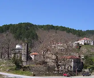
Doliani (Greek: Δόλιανη, Aromanian: Doljani) is a village and a community of the Zagori municipality in Ioannina Regional Unit, Greece.[2] Before the 2011 local government reform it was part of the municipality of East Zagori, of which it was a municipal district.[2] The 2021 census recorded 51 inhabitants in the village.[1] The community of Doliani covers an area of 17.276 km2.[3] Doliani is a traditional Aromanian (Vlach) settlement.
See also
References
- ^ a b "Αποτελέσματα Απογραφής Πληθυσμού - Κατοικιών 2021, Μόνιμος Πληθυσμός κατά οικισμό" [Results of the 2021 Population - Housing Census, Permanent population by settlement] (in Greek). Hellenic Statistical Authority. 29 March 2024.
- ^ a b "ΦΕΚ B 1292/2010, Kallikratis reform municipalities" (in Greek). Government Gazette.
- ^ "Population & housing census 2001 (incl. area and average elevation)" (PDF) (in Greek). National Statistical Service of Greece. Archived from the original (PDF) on 2015-09-21.