Downside, New South Wales
| Downside New South Wales | |
|---|---|
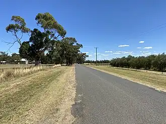 Downside Village Road in Downside | |
 Downside | |
| Coordinates | 34°58′35″S 147°20′39″E / 34.97639°S 147.34417°E |
| Population | 124 (2016 census)[1] |
| Postcode(s) | 2650 |
| Elevation | 279 m (915 ft) |
| Location |
|
| LGA(s) | City of Wagga Wagga |
| County | Clarendon |
| State electorate(s) | Wagga Wagga |
Downside is a farming community in the central east part of the Riverina and situated about 15 kilometres north west from Wagga Wagga and 24 kilometres south east from Coolamon.[2]
Downside Post Office opened on 15 August 1878 and closed in 1905.[3]
Notes and references
- ^ Australian Bureau of Statistics (27 June 2017). "Downside (State Suburb)". 2016 Census QuickStats. Retrieved 27 June 2017.
- ^ "Downside". Geographical Names Register (GNR) of NSW. Geographical Names Board of New South Wales. Retrieved 4 August 2013.
- ^ Premier Postal History. "Post Office List". Retrieved 11 June 2009.
Wikimedia Commons has media related to Downside, New South Wales.