Droop, West Virginia
Droop | |
|---|---|
 Droop Location within the state of West Virginia  Droop Droop (the United States) | |
| Coordinates: 38°5′6″N 80°17′5″W / 38.08500°N 80.28472°W | |
| Country | United States |
| State | West Virginia |
| County | Pocahontas |
| Time zone | UTC-5 (Eastern (EST)) |
| • Summer (DST) | UTC-4 (EDT) |
| ZIP codes | 24933 |
Droop is an unincorporated community in Pocahontas County, West Virginia, United States, in the Greenbrier River Valley.
The community takes its name from nearby Droop Mountain.[1] The area lends its name to Droop Mountain Battlefield State Park, site of West Virginia's last significant Civil War battle.[2] The Civilian Conservation Corps (CCC) constructed the park's trails and buildings in the 1930s, as part of Franklin D. Roosevelt's New Deal legislation. Today, a small museum on the park grounds houses Civil War artifacts and discusses the park's CCC history.[3] Bi-annually, the West Virginia Reenactors Association reenacts the Droop Mountain battle.[4]
-
 Snowy Day at Droop Mountain
 -
 Overlook at the Park
Places of interest
- Droop Mountain Battlefield State Park
- The Civilian Conservation Corps Museum, Civil War History
- Beartown State Park
- Hiking Trails at Both State Parks
- The nearby town of Hillsboro, West Virginia
- The Pearl S. Buck Birthplace
References
- ^ Kenny, Hamill (1945). West Virginia Place Names: Their Origin and Meaning, Including the Nomenclature of the Streams and Mountains. Piedmont, WV: The Place Name Press. p. 214.
- ^ Moyer, Armond; Moyer, Winifred (1958). The origins of unusual place-names. Keystone Pub. Associates. p. 38.
- ^ "Home". droopmountainbattlefield.com.
- ^ "Home". wvra.org.
External links
Municipalities and communities of Pocahontas County, West Virginia, United States | ||
|---|---|---|
| Towns | 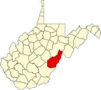 | |
| CDPs | ||
| Unincorporated communities |
| |
| Ghost towns | ||