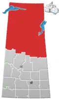
Eagle Point, Saskatchewan
Eagle Point | |
|---|---|
Cluster subdivision (designated place) | |
 Location of Eagle Point in Saskatchewan | |
| Coordinates: 55°07′37″N 105°15′47″W / 55.127°N 105.263°W | |
| Country | Canada |
| Province | Saskatchewan |
| Census division | No. 18 |
| District | Northern Saskatchewan Administration District |
| Government | |
| • Type | Unincorporated |
| Area | |
| • Land | 1.00 km2 (0.39 sq mi) |
| Population (2021)[1] | |
• Total | 105 |
| Time zone | UTC-6 (CST) |
| Area code | +1-306 |
Eagle Point is an unincorporated community and cluster subdivision within northern Saskatchewan, Canada. It is recognized as a designated place by Statistics Canada.
Geography
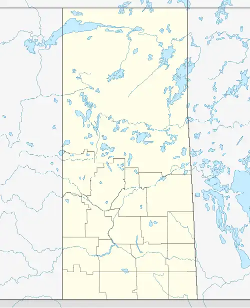
Eagle Point is on the western shore of Lac la Ronge.[2]
Demographics
In the 2021 Census of Population conducted by Statistics Canada, Eagle Point had a population of 105 living in 33 of its 36 total private dwellings, a change of 15.4% from its 2016 population of 91. With a land area of 1 km2 (0.39 sq mi), it had a population density of 105.0/km2 (271.9/sq mi) in 2021.[1]
References
- ^ a b c "Population and dwelling counts: Canada and designated places". Statistics Canada. February 9, 2022. Retrieved August 31, 2022.
- ^ "Designated Place 470247 Saskatchewan (DPL Name: Eagle Point, CS)" (PDF). Statistics Canada. December 14, 2022. Retrieved February 5, 2023.
Subdivisions of Saskatchewan | |
|---|---|
| Subdivisions | |
| Communities | |
| Cities | |
| Topics |
|
| |