Southern and Eastern Serbia
Southern and Eastern Serbia Јужна и источна Србија | |
|---|---|
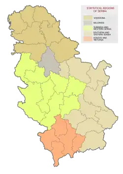
 Location of Southern and Eastern Serbia | |
| Country | |
| Founded | 2010 |
| Largest city | Niš |
| Area | |
• Total | 26,245 km2 (10,133 sq mi) |
| • Rank | 2nd |
| Population | |
• Total | 1,406,050 |
| • Rank | 4th |
| • Density | 54/km2 (140/sq mi) |
| GDP | |
| • Total | RSD 1,077.359 billion €9.172 billion (2022) |
| • Per capita | RSD 763,000 €6,496 (2022) |
| HDI[4] | 0.797 (2019) high · 4th in Serbia |
The Southern and Eastern Serbia (Serbian: Јужна и источна Србија, romanized: Južna i istočna Srbija) is one of five statistical regions of Serbia. It is also a Level-2 statistical region according to the Nomenclature of Territorial Units for Statistics (NUTS).
History
In 2009, the National Assembly adopted a law which divided Serbia into seven statistical regions.[5] At first, it was decided that in the territory of current statistical region of Southern and Eastern Serbia there would be two statistical regions – Eastern Region (Serbian: Источни регион, romanized: Istočni region) and Southern Region (Serbian: Јужни регион, romanized: Južni region). However, in 2010, the law was changed, thus the Eastern and Southern regions were merged into a single statistical region named Southern and Eastern Serbia.
Administrative districts
The statistical region of Southern and Eastern Serbia encompasses 9 administrative districts:
| District | Area (km2) | Population (2022) | Seat |
|---|---|---|---|
| Podunavlje | 1,250 | 175,573 | Smederevo |
| Braničevo | 3,865 | 156,367 | Požarevac |
| Bor | 3,510 | 101,100 | Bor |
| Zaječar | 3,623 | 96,715 | Zaječar |
| Nišava | 2,727 | 343,950 | Niš |
| Pirot | 2,761 | 76,700 | Pirot |
| Toplica | 2,229 | 77,341 | Prokuplje |
| Jablanica | 2,770 | 184,502 | Leskovac |
| Pčinja | 3,520 | 193,802 | Vranje |
Demographics
The region is heavily affected by depopulation. Most critical situation is in municipalities of Gadžin Han, Crna Trava, Ražanj, Trgovište, Dimitrovgrad, and Bosilegrad. A stark example of depopulation is Crna Trava, which used to have 13,614 inhabitants in 1948, while in 2022 only 1,063 people were registered.[6]
Cities and towns
The following list include cities and towns with over 20,000 inhabitants.
| City or town | Population (2022)[7] |
|---|---|
| Niš | 182,797 |
| Smederevo | 59,261 |
| Leskovac | 58,338 |
| Vranje | 50,954 |
| Požarevac | 42,530 |
| Pirot | 34,942 |
| Zaječar | 32,448 |
| Bor | 28,822 |
| Prokuplje | 24,627 |
| Smederevska Palanka | 20,345 |
Ethnic structure
| Ethnicity | Population (2022)[8] | Percentage |
|---|---|---|
| Serbs | 1,173,092 | 83.4% |
| Albanians | 58,145 | 4.1% |
| Roma | 50,671 | 3.6% |
| Vlachs | 19,569 | 1.4% |
| Bulgarians | 10,554 | 0.7% |
| Undeclared | 20,495 | 1.4% |
| Unknown | 59,725 | 4.2% |
See also
References
- ^ "Региони у Републици Србији" (pdf). stat.gov.rs (in Serbian). Statistical Office of Serbia. 16 October 2019. Retrieved 16 October 2019.
- ^ "Први резултати Пописa становништва, домаћинстава и станова 2022". stat.gov.rs (in Serbian). Statistical Office of Serbia. 21 December 2022. Retrieved 21 December 2022.
- ^ "REGIONAL GROSS DOMESTIC PRODUCT Regions and areas of the Republic of Serbia, 2023" (PDF).
- ^ "Sub-national HDI - Area Database - Global Data Lab". hdi.globaldatalab.org. Retrieved 2021-07-19.
- ^ "Uvedeno sedam statističkih regiona". B92.net (in Serbian). Retrieved 2021-03-02.
- ^ "SANU: Jug Srbije sve prazniji, potrebne sistemske promene". Južne vesti. 25 March 2019.
- ^ "Serbia: Regions, Districts and Major Cities – Population Statistics, Maps, Charts, Weather and Web Information".
- ^ "Ethnicity - Data by municipalities and cities" (PDF). Archived from the original (PDF) on 2023-04-28.
External links