Ees, Drenthe
Ees | |
|---|---|
 Farm in Ees | |
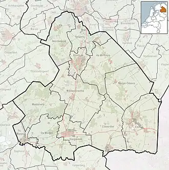 Ees Location in the province of Drenthe in the Netherlands | |
| Coordinates: 52°54′N 6°48′E / 52.900°N 6.800°E | |
| Country | Netherlands |
| Province | Drenthe |
| Municipality | Borger-Odoorn |
| Area | |
• Total | 7.79 km2 (3.01 sq mi) |
| Elevation | 17 m (56 ft) |
| Population (2021)[1] | |
• Total | 325 |
| • Density | 42/km2 (110/sq mi) |
| Time zone | UTC+1 (CET) |
| • Summer (DST) | UTC+2 (CEST) |
| Postal code | 9536[1] |
| Dialing code | 0599 |
Ees is a village in the Dutch province of Drenthe. It is a part of the municipality of Borger-Odoorn, and lies about 17 km north of Emmen.
The village was first mentioned in 1263 as de Ese, and means "farmland around a village".[3]
Situated close to the town of Borger, Ees retains a provincial charm that is characterised by pleasant homes and a large expanse of woodland to the South East. A network of bike paths and horse trails (ruiterpads) throughout the woods provides for some peaceful treks.
References
- ^ a b c "Kerncijfers wijken en buurten 2021". Central Bureau of Statistics. Retrieved 27 April 2022.
- ^ "Postcodetool for 9536PA". Actueel Hoogtebestand Nederland (in Dutch). Het Waterschapshuis. Archived from the original on 21 September 2013. Retrieved 27 April 2022.
- ^ "Ees - (geografische naam)". Etymologiebank (in Dutch). Retrieved 27 April 2022.
Wikimedia Commons has media related to Ees.