Pulau River
| Pulau River Eilandenrivier | |
|---|---|
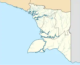 Location of river mouth | |
| Native name |
|
| Location | |
| Country | Indonesia |
| Province | South Papua |
| Regency | Asmat |
| Physical characteristics | |
| Source | |
| • location | Jayawijaya Mountains, Highland Papua, Indonesia |
| • coordinates | 4°38′11.688″S 140°7′47.208″E / 4.63658000°S 140.12978000°E |
| • elevation | 4,000 m (13,000 ft) |
| Mouth | |
• location | Arafura Sea |
• coordinates | 5°48′44.4204″S 138°9′40.2444″E / 5.812339000°S 138.161179000°E |
• elevation | 0 m (0 ft) |
| Length | 674 km (419 mi)[1] |
| Basin size | 37,164 km2 (14,349 sq mi)[1] |
| Discharge | |
| • location | Eilanden Delta |
| • average | 3,133 m3/s (110,600 cu ft/s)[1] |
| Basin features | |
| Progression | Arafura Sea |
| River system | Eilanden River |
| Tributaries | |
| • left | Wildeman, Kampung, Doyusi |
| • right | Weehuizen, Kolff, Brazza, Baliem, Urumbuwe |
The Pulau River (Indonesian: Sungai Pulau, Dutch: Eilandenrivier) is a major river in South Papua province of Indonesia, with a total length of 674 km (419 mi).[2]
Name
It was previously known as the Eilanden River based on Dutch colonial expedition maps,[3] and was still shown with this name on some government maps in the 2010s.[4][5]
Geography
The Pulau River has its source in the Jayawijaya Mountains near Puncak Mandala, around 4,000 m (13,000 ft) in elevation. It flows south out of the mountains, and then follows a south-southwesterly course to the Arafura Sea on the Casuarina Coast.[3] Important tributaries include the Baliem (formerly Vriendschaps), Wildeman, Kampung and Brazza.
Hydrology
The river flows in the southern area of Western New Guinea with predominantly a tropical rainforest climate (designated as Af in the Köppen-Geiger climate classification).[6] The annual average temperature in the area is 22 °C (72 °F). The warmest month is January, when the average temperature is around 24 °C (75 °F), and the coldest is June, at 20 °C (68 °F).[7] The average annual rainfall is 3,997–5,547 mm (157.4–218.4 in).[1] The wettest month is May, with an average of 594 mm (23.4 in) rainfall, and the driest is July, with 384 mm (15.1 in) rainfall.[8]
Discharge
| Period | Average discharge | Ref. |
|---|---|---|
| Eilanden Delta
5°48′44.4204″S 138°9′40.2444″E / 5.812339000°S 138.161179000°E | ||
| Eilanden with Lorentz at the Delta | ||
| 3,783.1 m3/s (133,600 cu ft/s)* | [9] | |
| 2002–2011 | 3,513 m3/s (124,100 cu ft/s) | [1] |
| 2002–2018 | 107.72197 km3/a (3,413.503 m3/s) | [10] |
| Eilanden at the delta | ||
| 2015–2019 | 2,084 m3/s (73,600 cu ft/s) | [11] |
| 2003–2015 | 80.4 km3/a (2,550 m3/s) | [12] |
| 2002–2011 | 3,133 m3/s (110,600 cu ft/s) | [1] |
*Monthly flow (Q) m3/s:
| Month | Q |
|---|---|
| JAN | 3,294.5 |
| FEB | 3,812.8 |
| MAR | 3,816.3 |
| APR | 3,990.7 |
| MAY | 4,380.8 |
| JUN | 3,816 |
| JUL | 3,022.4 |
| AUG | 2,811.9 |
| SEP | 3,624 |
| OCT | 4,176.9 |
| NOV | 4,505.6 |
| DEC | 4,144.7 |
| Avg. | 3,783.1 |
Tributaries
| Left tributary | Right
tributary |
Length (km) | Basin size (km2) | Average discharge (m3/s) |
|---|---|---|---|---|
| Eilanden (Pulau) | 674 | 37,164 | 3,133 | |
| Urumbuwe | 240 | 2,690.5 | 294.6 | |
| Doyusi | 200 | 1,208.4 | 165.3 | |
| Kampung | 290 | 2,133 | 264.1 | |
| Baliem (Vriends-chaps) | 414.2 | 12,974.1 | 791.3 | |
| Wildeman | 330 | 3,412 | 327.1 | |
| Brazza | 270 | 2,113.8 | 120.6 | |
| Kolff | 2,755.9 | 199.1 | ||
| Weehuizen (Boven Digoel) | 110 | 577.6 | 68.9 | |
See also
- List of drainage basins of Indonesia
- List of rivers of Oceania
- List of rivers of Indonesia
- List of rivers of Western New Guinea
- Southern New Guinea freshwater swamp forests
- List of rivers by discharge
References
- ^ a b c d e f van Beek, E.; Bons, K.; Brinkman, J. (2013). "Final report Einlanden-Digul-Bikuma basin IWRM case study".
- ^ Sungai Eilanden – Geonames.org.
- ^ a b "1916 Netherlands New Guinea Map". G. Kolff & Co.
- ^ "Peta Struktur Ruang". Archived from the original on 20 October 2018. Retrieved 31 July 2018.
- ^ DIREKTORAT JENDERAL BINA USAHA KEHUTANAN KEMENTERIAN KEHUTANAN
- ^ Peel, M C; Finlayson, B L; McMahon, T A (2007). "Updated world map of the Köppen-Geiger climate classification". Hydrology and Earth System Sciences. 11 (5): 1633–1644. doi:10.5194/hess-11-1633-2007.
- ^ "NASA Earth Observations Data Set Index". NASA. 30 January 2016.
- ^ "NASA Earth Observations: Rainfall (1 month – TRMM)". NASA/Tropical Rainfall Monitoring Mission. 30 January 2016.
- ^ a b Firmansyah, Rendy. "Grafik Neraca Air Pulau Papua".
- ^ Prof. Dr. Ir., San Afri Awang; Sasmita, Nugroho; Dr., Julijanti; Isluyandari, Woelan Yanuartanti (2019). 2018 BUKU 1-KAJIAN PENGANYAN PEMBANGUNAN PULAU PAPUA (PDF).
- ^ PENGELOLAAN SUMBER DAYA AIR WILAYAH SUNGAI EINLANDEN-DIGUL-BIKUMA (PDF). 2021.
- ^ Radhika, Radhika; Firmansyah, Rendy; Hatmoko, Waluyo (November 2017). "Computation of surface water availability in Indonesia based on satellite data". Jurnal Sumber Daya Air. 13 (2): 115–130. doi:10.32679/jsda.v13i2.206.
- ^ "Papua New Guinea".