Eszteregnye
Eszteregnye | |
|---|---|
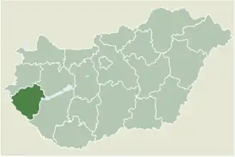 Location of Zala county in Hungary | |
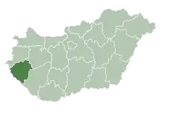
 Eszteregnye Location of Eszteregnye | |
| Coordinates: 46°28′17″N 16°52′58″E / 46.47137°N 16.88273°E | |
| Country | |
| County | Zala |
| Area | |
• Total | 20.09 km2 (7.76 sq mi) |
| Population (2004) | |
• Total | 767 |
| • Density | 38.17/km2 (98.9/sq mi) |
| Time zone | UTC+1 (CET) |
| • Summer (DST) | UTC+2 (CEST) |
| Postal code | 8882 |
| Area code | 93 |
| Motorways | M7 |
| Distance from Budapest | 220 km (140 mi) Northeast |
Eszteregnye (Croatian: Strugna) is a village in Zala County, Hungary.
External links
- Street map (in Hungarian)
.svg.png)