Föritztal
Föritztal | |
|---|---|
Logo of the municipality | |
Location of Föritztal within Sonneberg district 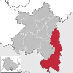 | |
 Föritztal  Föritztal | |
| Coordinates: 50°21′0″N 11°14′30″E / 50.35000°N 11.24167°E | |
| Country | Germany |
| State | Thuringia |
| District | Sonneberg |
| Government | |
| • Mayor (2024–) | Silke Fischer[1] (CDU) |
| Area | |
• Total | 98.5 km2 (38.0 sq mi) |
| Elevation | 630 m (2,070 ft) |
| Population (2024-12-31)[2] | |
• Total | 8,183 |
| • Density | 83/km2 (220/sq mi) |
| Time zone | UTC+01:00 (CET) |
| • Summer (DST) | UTC+02:00 (CEST) |
| Postal codes | 96524 |
| Dialling codes | 03675, 036764, 036761 |
| Vehicle registration | SON, NH |
| Website | foeritztal.de |
Föritztal (German pronunciation: [ˈføːʁɪtsˌtaːl], lit. 'Föritz Valley') is a municipality in the Sonneberg district of Thuringia, Germany. It was formed on 6 July 2018 by the merger of the former municipalities Föritz, Judenbach and Neuhaus-Schierschnitz.[3] It takes its name from the small river Föritz, a tributary of the Steinach.
Subdivisions
The municipality Föritztal consists of the following villages:
|
|
Wikimedia Commons has media related to Föritztal.
References
- ^ Gewählte Bürgermeister - aktuelle Landesübersicht, Freistaat Thüringen, accessed 17 May 2025.
- ^ "Bevölkerung der Gemeinden vom Thüringer Landesamt für Statistik" (in German). Thüringer Landesamt für Statistik.
- ^ Thüringer Gesetz zur freiwilligen Neugliederung kreisangehöriger Gemeinden im Jahr 2018 (ThürGNGG 2018), Gesetz- und Verordnungsblatt Thüringen (in German). August 2018
Towns and municipalities in Sonneberg (district) | ||
|---|---|---|