Flaurling
Flaurling | |
|---|---|
 | |
 Coat of arms | |
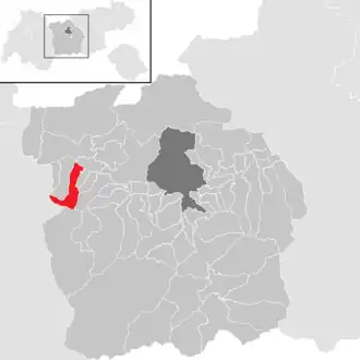 Location in the district | |
 Flaurling Location within Austria | |
| Coordinates: 47°17′32″N 11°07′23″E / 47.29222°N 11.12306°E | |
| Country | Austria |
| State | Tyrol |
| District | Innsbruck Land |
| Government | |
| • Mayor | Brigitte Praxmarer (SPÖ) |
| Area | |
• Total | 19.64 km2 (7.58 sq mi) |
| Elevation | 675 m (2,215 ft) |
| Population (2018-01-01)[2] | |
• Total | 1,285 |
| • Density | 65/km2 (170/sq mi) |
| Time zone | UTC+1 (CET) |
| • Summer (DST) | UTC+2 (CEST) |
| Postal code | 6403 |
| Area code | 05262 |
| Vehicle registration | IL |
| Website | www.flaurling.tirol.gv.at |
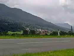
Flaurling is a municipality in the district Innsbruck country in Tyrol (Austria). It lies in the Inn valley between Innsbruck and Telfs south of the Inn River.
The municipality consists of the areas: Flaurling village, Flaurling station with a commercial district and Flaurlingberg at the western foothills of a low mountain range terrace. It was mentioned documentarily for the first time as "Flurininga" in the year 763.
Population
| Year | Pop. | ±% |
|---|---|---|
| 1869 | 556 | — |
| 1880 | 542 | −2.5% |
| 1890 | 517 | −4.6% |
| 1900 | 441 | −14.7% |
| 1910 | 493 | +11.8% |
| 1923 | 531 | +7.7% |
| 1934 | 583 | +9.8% |
| 1939 | 578 | −0.9% |
| 1951 | 701 | +21.3% |
| 1961 | 712 | +1.6% |
| 1971 | 884 | +24.2% |
| 1981 | 908 | +2.7% |
| 1991 | 976 | +7.5% |
| 2001 | 1,106 | +13.3% |
| 2011 | 1,224 | +10.7% |
| 2015 | 1,285 | +5.0% |
Twin towns
References
- ^ "Dauersiedlungsraum der Gemeinden Politischen Bezirke und Bundesländer - Gebietsstand 1.1.2018". Statistics Austria. Retrieved 10 March 2019.
- ^ "Einwohnerzahl 1.1.2018 nach Gemeinden mit Status, Gebietsstand 1.1.2018". Statistics Austria. Retrieved 9 March 2019.
External links
Wikimedia Commons has media related to Flaurling.