Fléron
Fléron | |
|---|---|
 | |
 Flag  Coat of arms | |
Location of Fléron | |
 Fléron Location in Belgium
Location of Fléron in Liège province 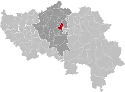 | |
| Coordinates: 50°37′N 05°41′E / 50.617°N 5.683°E | |
| Country | Belgium |
| Community | French Community |
| Region | |
| Province | |
| Arrondissement | Liège |
| Government | |
| • Mayor | Thierry Ancion (IC) |
| • Governing party/ies | IC |
| Area | |
• Total | 13.68 km2 (5.28 sq mi) |
| Population (2018-01-01)[1] | |
• Total | 16,495 |
| • Density | 1,200/km2 (3,100/sq mi) |
| Postal codes | 4620-4624 |
| NIS code | 62038 |
| Area codes | 04 |
| Website | www.fleron.be |
Fléron (French pronunciation: [fleʁɔ̃] ⓘ; Walloon: Fléron) is a municipality of Wallonia located in the province of Liège, Belgium.
On January 1, 2006, Fléron had a total population of 16,088. The total area is 13.72 km2 (5 sq mi) which gives a population density of 1,172 inhabitants per km2. Fléron is east of the city of Liège.
The municipality consists of the following districts: Fléron, Magnée, Retinne, and Romsée.
The reminders of Fort de Fléron are in the center of the village of Fléron.
Image gallery
-
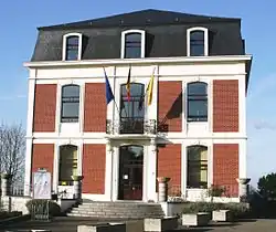 Fléron town hall
 -
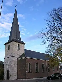 Fléron St. Denis
 -
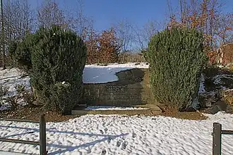 Fort de Fléron
 -
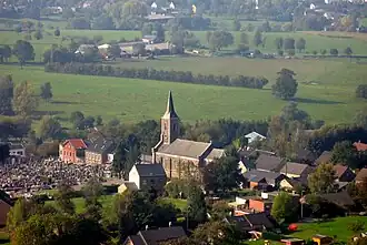 Retinne
See also
References
- ^ "Wettelijke Bevolking per gemeente op 1 januari 2018". Statbel. Retrieved 9 March 2019.
External links
 Media related to Fléron at Wikimedia Commons
Places adjacent to Fléron | ||||||||||||||||
|---|---|---|---|---|---|---|---|---|---|---|---|---|---|---|---|---|
| ||||||||||||||||
Municipalities in the province of Liège, Wallonia | ||
|---|---|---|
| Huy | 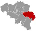 | |
| Liège | ||
| Verviers | ||
| Waremme | ||
| ||