Fleurigné
Fleurigné
| |
|---|---|
Part of La Chapelle-Fleurigné | |
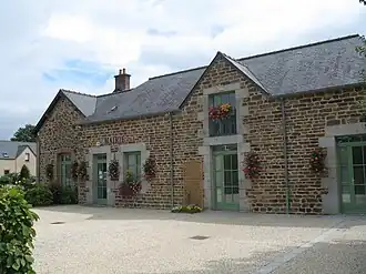 Town hall | |
Location of Fleurigné | |
 Fleurigné  Fleurigné | |
| Coordinates: 48°20′10″N 1°07′11″W / 48.3361°N 1.1197°W | |
| Country | France |
| Region | Brittany |
| Department | Ille-et-Vilaine |
| Arrondissement | Fougères-Vitré |
| Canton | Fougères-2 |
| Commune | La Chapelle-Fleurigné |
Area 1 | 18.17 km2 (7.02 sq mi) |
| Population (2021)[1] | 917 |
| • Density | 50/km2 (130/sq mi) |
| Time zone | UTC+01:00 (CET) |
| • Summer (DST) | UTC+02:00 (CEST) |
| Postal code | 35133 |
| Elevation | 79–233 m (259–764 ft) |
| 1 French Land Register data, which excludes lakes, ponds, glaciers > 1 km2 (0.386 sq mi or 247 acres) and river estuaries. | |
Fleurigné (French pronunciation: [flœʁiɲe]; Breton: Flurinieg; Gallo: Floereinyaè) is a former commune in the Ille-et-Vilaine department in Brittany in northwestern France. It was merged with La Chapelle-Janson to form La Chapelle-Fleurigné on 1 January 2024.[2]
Population
| Year | Pop. | ±% p.a. |
|---|---|---|
| 1968 | 674 | — |
| 1975 | 676 | +0.04% |
| 1982 | 812 | +2.65% |
| 1990 | 841 | +0.44% |
| 1999 | 896 | +0.71% |
| 2009 | 1,032 | +1.42% |
| 2014 | 1,022 | −0.19% |
| 2020 | 927 | −1.61% |
| Source: INSEE[3] | ||
Inhabitants of Fleurigné are called Fleurignéens in French.
See also
References
- ^ "Populations légales 2021" [Legal populations 2021] (PDF) (in French). INSEE. December 2023.
- ^ "Recueil des actes administratifs d'Ille-et-Vilaine 2023" (Pdf).
- ^ Population en historique depuis 1968, INSEE
External links
Wikimedia Commons has media related to Fleurigné.
- Base Mérimée: Search for heritage in the commune, Ministère français de la Culture. (in French)