Frantschach-Sankt Gertraud
Frantschach-St. Gertraud | |
|---|---|
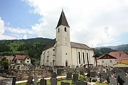 Church | |
 Coat of arms | |
 Frantschach-St. Gertraud Location within Austria | |
| Coordinates: 46°52′N 14°52′E / 46.867°N 14.867°E | |
| Country | Austria |
| State | Carinthia |
| District | Wolfsberg |
| Government | |
| • Mayor | Günther Vallant |
| Area | |
• Total | 100.97 km2 (38.98 sq mi) |
| Elevation | 503 m (1,650 ft) |
| Population (2018-01-01)[2] | |
• Total | 2,605 |
| • Density | 26/km2 (67/sq mi) |
| Time zone | UTC+1 (CET) |
| • Summer (DST) | UTC+2 (CEST) |
| Postal code | 9413 |
| Area code | 04252 |
| Website | www.frantschach-st-gertraud.gv.at |
Frantschach-Sankt Gertraud is a town in the district of Wolfsberg in the Austrian state of Carinthia.
Geography
The municipality lies north of Wolfsberg on the boundary with Styria.
References
- ^ "Dauersiedlungsraum der Gemeinden Politischen Bezirke und Bundesländer - Gebietsstand 1.1.2018". Statistics Austria. Retrieved 10 March 2019.
- ^ "Einwohnerzahl 1.1.2018 nach Gemeinden mit Status, Gebietsstand 1.1.2018". Statistics Austria. Retrieved 9 March 2019.
Wikimedia Commons has media related to Frantschach-Sankt Gertraud.