Gabersdorf
Gabersdorf | |
|---|---|
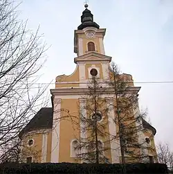 Gabersdorf parish church | |
 Coat of arms | |
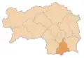
 Gabersdorf Location within Austria | |
| Coordinates: 46°46′56.5638″N 15°35′13.7898″E / 46.782378833°N 15.587163833°E | |
| Country | Austria |
| State | Styria |
| District | Leibnitz |
| Government | |
| • Mayor | Franz Hierzer (ÖVP) |
| Area | |
• Total | 19.81 km2 (7.65 sq mi) |
| Elevation | 274 m (899 ft) |
| Population (2018-01-01)[2] | |
• Total | 1,227 |
| • Density | 62/km2 (160/sq mi) |
| Time zone | UTC+1 (CET) |
| • Summer (DST) | UTC+2 (CEST) |
| Postal code | 8424 |
| Area code | 03452 |
| Vehicle registration | LB |
| Website | www.gabersdorf.at |
Gabersdorf (German: [ˈɡaːbɐsˌdɔɐ̯f, ˈɡaːbeʁsˌdɔʁf]) is a municipality in the district of Leibnitz in the Austrian state of Styria.
Geography
Gabersdorf lies east of Leibnitz between the east Styrian hills and the Mur river.
References
- ^ "Dauersiedlungsraum der Gemeinden Politischen Bezirke und Bundesländer - Gebietsstand 1.1.2018". Statistics Austria. Retrieved 10 March 2019.
- ^ "Einwohnerzahl 1.1.2018 nach Gemeinden mit Status, Gebietsstand 1.1.2018". Statistics Austria. Retrieved 9 March 2019.