Garfield, Georgia
Garfield, Georgia | |
|---|---|
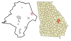 Location in Emanuel County and the state of Georgia | |
| Coordinates: 32°39′2″N 82°5′47″W / 32.65056°N 82.09639°W | |
| Country | United States |
| State | Georgia |
| County | Emanuel |
| Area | |
• Total | 0.80 sq mi (2.06 km2) |
| • Land | 0.79 sq mi (2.04 km2) |
| • Water | 0.01 sq mi (0.02 km2) |
| Elevation | 279 ft (85 m) |
| Population (2020) | |
• Total | 257 |
| • Density | 326.14/sq mi (125.88/km2) |
| Time zone | UTC-5 (Eastern (EST)) |
| • Summer (DST) | UTC-4 (EDT) |
| ZIP code | 30425 |
| Area code | 478 |
| FIPS code | 13-32188[2] |
| GNIS feature ID | 0331791[3] |
Garfield is a city in Emanuel County, Georgia, United States. The population was 257 in 2020.
History
The Georgia General Assembly incorporated the place as the Town of Garfield in 1905.[4]
Geography
Garfield is located in eastern Emanuel County at 32°39′2″N 82°5′47″W / 32.65056°N 82.09639°W (32.650511, -82.096319).[5] Georgia State Route 23 passes through the city, leading northeast 14 miles (23 km) to Millen and southwest 6 miles (10 km) to Twin City. Swainsboro, the Emanuel County seat, is 16 miles (26 km) to the west.
According to the United States Census Bureau, Garfield has a total area of 0.81 square miles (2.1 km2), of which 0.01 square miles (0.02 km2), or 0.86%, is water.[6]
Demographics
| Census | Pop. | Note | %± |
|---|---|---|---|
| 1910 | 319 | — | |
| 1920 | 416 | 30.4% | |
| 1930 | 342 | −17.8% | |
| 1940 | 291 | −14.9% | |
| 1950 | 213 | −26.8% | |
| 1960 | 225 | 5.6% | |
| 1970 | 214 | −4.9% | |
| 1980 | 222 | 3.7% | |
| 1990 | 255 | 14.9% | |
| 2000 | 152 | −40.4% | |
| 2010 | 201 | 32.2% | |
| 2020 | 257 | 27.9% | |
| U.S. Decennial Census[7] | |||
As of the census[2] of 2000, there were 152 people, 65 households, and 46 families residing in the town. By the 2020 census, its population increased to 257.
References
- ^ "2020 U.S. Gazetteer Files". United States Census Bureau. Retrieved December 18, 2021.
- ^ a b "U.S. Census website". United States Census Bureau. Retrieved January 31, 2008.
- ^ "US Board on Geographic Names". United States Geological Survey. October 25, 2007. Retrieved January 31, 2008.
- ^ Acts and Resolutions of the General Assembly of the State of Georgia. State printer. 1905. p. 829.
- ^ "US Gazetteer files: 2010, 2000, and 1990". United States Census Bureau. February 12, 2011. Retrieved April 23, 2011.
- ^ "Geographic Identifiers: 2010 Demographic Profile Data (G001): Garfield city, Georgia". American Factfinder. U.S. Census Bureau. Archived from the original on February 13, 2020. Retrieved January 27, 2016.
- ^ "Census of Population and Housing". Census.gov. Retrieved June 4, 2015.
Municipalities and communities of Emanuel County, Georgia, United States | ||
|---|---|---|
| Cities |  | |
| CDPs | ||
| Unincorporated communities | ||
| Footnotes | ‡This populated place also has portions in an adjacent county or counties | |