Gilboa Township, Benton County, Indiana
Gilboa Township | |
|---|---|
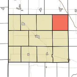 Location of Gilboa Township in Benton County | |
| Coordinates: 40°41′36″N 87°09′31″W / 40.69333°N 87.15861°W | |
| Country | United States |
| State | Indiana |
| County | Benton |
| Organized | December 1866 |
| Government | |
| • Type | Indiana township |
| Area | |
• Total | 35.94 sq mi (93.1 km2) |
| • Land | 35.94 sq mi (93.1 km2) |
| • Water | 0 sq mi (0 km2) |
| Elevation | 758 ft (231 m) |
| Population (2020) | |
• Total | 282 |
| • Density | 7/sq mi (3/km2) |
| Time zone | UTC-5 (EST) |
| • Summer (DST) | UTC-4 (EDT) |
| Area code | 765 |
| FIPS code | 18-27630[2] |
| GNIS feature ID | 453330 |
Gilboa Township is one of eleven townships in Benton County, Indiana.[3] As of the 2020 census, its population was 282 and it contained 100 housing units.[4] It is named for Mount Gilboa, a prominence in the southern part of the township.[5] It was created in 1866 out of the northern part of Pine Township, after the petition of 21 residents there.[6]
| Census | Pop. | Note | %± |
|---|---|---|---|
| 1890 | 854 | — | |
| 1900 | 839 | −1.8% | |
| 1910 | 721 | −14.1% | |
| 1920 | 705 | −2.2% | |
| 1930 | 625 | −11.3% | |
| 1940 | 578 | −7.5% | |
| 1950 | 513 | −11.2% | |
| 1960 | 442 | −13.8% | |
| 1970 | 363 | −17.9% | |
| 1980 | 311 | −14.3% | |
| 1990 | 281 | −9.6% | |
| 2000 | 241 | −14.2% | |
| 2010 | 250 | 3.7% | |
| 2020 | 282 | 12.8% | |
| Source: US Decennial Census[7] | |||
Geography
According to the 2020 census, the township has a total area of 35.94 square miles (93.1 km2), all land.[4]
Adjacent townships
- Center (southwest)
- Pine (south)
- Union (west)
- Carpenter Township, Jasper County (north)
- Princeton Township, White County (northeast)
- Round Grove Township, White County (southeast)
- West Point Township, White County (east)
Education
- Gilboa Township is served by the Tri-County School Corporation,[8] which also serves Carpenter Township in Jasper County and Princeton, West Point, and Round Grove Townships in White County.
References
Citations
- ^ "US Board on Geographic Names". United States Geological Survey. October 25, 2007. Retrieved January 31, 2008.
- ^ "U.S. Census website". United States Census Bureau. Retrieved January 31, 2008.
- ^ "Gilboa Township, Benton County, Indiana". Geographic Names Information System. United States Geological Survey. Retrieved March 1, 2020.
- ^ a b "Explore Census Data". U.S. Census Bureau. Retrieved February 18, 2022.
- ^ Birch, Jesse Setlington (1942) [1928]. History of Benton County and Historic Oxford. Oxford, Indiana: Craw & Craw, Inc. p. 21.
- ^ "Counties of Warren, Benton, Jasper, and Newton counties, Indiana". Indiana State Library Digital Collections. 1883. p. 225. Retrieved June 3, 2022.
- ^ "Township Census Counts: STATS Indiana".
- ^ Geography Division. 2020 CENSUS - SCHOOL DISTRICT REFERENCE MAP: Benton County, IN (PDF) (Map). U.S. Census Bureau. Retrieved June 8, 2025. - Text list
Sources
- "Gilboa Township, Benton County, Indiana". Geographic Names Information System. United States Geological Survey, United States Department of the Interior. Retrieved September 24, 2009.
- United States Census Bureau cartographic boundary files
External links
Wikimedia Commons has media related to Gilboa Township, Benton County, Indiana.
Municipalities and communities of Benton County, Indiana, United States | ||
|---|---|---|
| Towns |  | |
| Townships | ||
| CDPs | ||
| Other communities |
| |
| Ghost towns | ||
| Footnotes | ‡This populated place also has portions in an adjacent county or counties | |