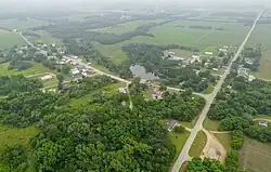
Gilmanton (community), Wisconsin
Gilmanton, Wisconsin | |
|---|---|
 | |
 Gilmanton  Gilmanton | |
| Coordinates: 44°28′15″N 91°40′34″W / 44.47083°N 91.67611°W | |
| Country | |
| State | |
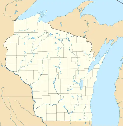
| County | Buffalo |
| Town | Gilmanton |
| Area | |
• Total | 3.378 sq mi (8.75 km2) |
| • Land | 3.345 sq mi (8.66 km2) |
| • Water | 0.033 sq mi (0.09 km2) |
| Elevation | 781 ft (238 m) |
| Population (2017)[2] | |
• Total | 131 |
| • Density | 39/sq mi (15/km2) |
| Time zone | UTC-6 (Central (CST)) |
| • Summer (DST) | UTC-5 (CDT) |
| ZIP code | 54743 |
| Area codes | 715 & 534 |
| GNIS feature ID | 1565537[3] |
Gilmanton (/ˈɡɪlməntən/ GHIL-mən-tən)[4] is a census-designated place located in the town of Gilmanton, in Buffalo County, Wisconsin, United States. Gilmanton is located at the junction of Wisconsin Highway 88 and Wisconsin Highway 121 7 miles (11 km) south of Mondovi.[5] Gilmanton has a post office with ZIP code 54743.[6] Its population was 131 in 2017.[2]
References
- ^ "Gazetteer Files - Places: Wisconsin". Geographies. U.S. Census Bureau. Retrieved September 23, 2019.
- ^ a b "Gilmanton CDP, Wisconsin". American FactFinder. U.S. Census Bureau. Archived from the original on February 14, 2020. Retrieved September 23, 2019.
- ^ U.S. Geological Survey Geographic Names Information System: Gilmanton (community), Wisconsin
- ^ MissPronouncer.com: A HALFWAY DECENT AUDIO PRONUNCIATION GUIDE FOR WISCONSIN
- ^ Buffalo County (PDF) (Map). Wisconsin Department of Transportation. Archived from the original (PDF) on May 16, 2011. Retrieved November 4, 2010.
- ^ "ZIP Code Lookup". Archived from the original on June 15, 2011. Retrieved November 4, 2010.
Municipalities and communities of Buffalo County, Wisconsin, United States | ||
|---|---|---|
| Cities |  | |
| Villages | ||
| Towns | ||
| CDPs | ||
| Unincorporated communities | ||
| Railroad junctions | ||
| Ghost towns | ||