Glénac
Glénac
Glenneg | |
|---|---|
Part of La Gacilly | |
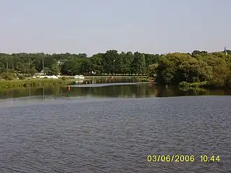 The marina at Glénac, on the Oust river | |
.svg.png) Coat of arms | |
Location of Glénac | |
 Glénac  Glénac | |
| Coordinates: 47°43′39″N 2°07′55″W / 47.7275°N 2.1319°W | |
| Country | France |
| Region | Brittany |
| Department | Morbihan |
| Arrondissement | Vannes |
| Canton | Guer |
| Commune | La Gacilly |
Area 1 | 13.70 km2 (5.29 sq mi) |
| Population (2022)[1] | 908 |
| • Density | 66/km2 (170/sq mi) |
| Time zone | UTC+01:00 (CET) |
| • Summer (DST) | UTC+02:00 (CEST) |
| Postal code | 56200 |
| Elevation | 2–87 m (6.6–285.4 ft) |
| 1 French Land Register data, which excludes lakes, ponds, glaciers > 1 km2 (0.386 sq mi or 247 acres) and river estuaries. | |
Glénac (French pronunciation: [ɡlenak]; Breton: Glenneg) is a former commune in the Morbihan department of Brittany in north-western France.[2] On 1 January 2017, it was merged into the commune La Gacilly.[3] Its population was 908 in 2022.[1] Inhabitants of Glénac are called in French Glénacois.
See also
References
- ^ a b "Populations de référence 2022" [Reference populations 2022] (PDF) (in French). INSEE. December 2024.
- ^ Des villages de Cassini aux communes d'aujourd'hui: Commune data sheet Glénac, EHESS (in French).
- ^ Arrêté préfectoral 13 July 2016 (in French)
External links
Wikimedia Commons has media related to Glénac.
- Base Mérimée: Search for heritage in the commune, Ministère français de la Culture. (in French)