Goura, Corinthia
Goura
Γκούρα | |
|---|---|
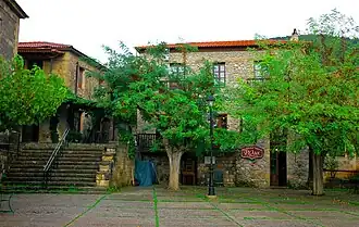 Goura's main square | |
 Goura | |
| Coordinates: 37°55′59″N 22°20′28″E / 37.933°N 22.341°E | |
| Country | Greece |
| Administrative region | Peloponnese |
| Regional unit | Corinthia |
| Municipality | Sikyona |
| Municipal unit | Feneos |
| Elevation | 956 m (3,136 ft) |
| Population (2021)[1] | |
• Community | 233 |
| Time zone | UTC+2 (EET) |
| • Summer (DST) | UTC+3 (EEST) |
| Area code(s) | 200 14 |
| Vehicle registration | ΚΡ |
Goura (Greek: Γκούρα) is a settlement in Corinthia, Greece. It is located at an altitude of 950 metres on the western slopes of Mount Zireia in the valley of the river Olvios, 91 kilometres south-west of Corinth. The village is named after the hero of the Greek War of Independence, Nikolaos Oikonomou-Gouras. His house, along with those of fellow-fighters Sarlis and Mourtis, still stands.
References
- ^ "Αποτελέσματα Απογραφής Πληθυσμού - Κατοικιών 2021, Μόνιμος Πληθυσμός κατά οικισμό" [Results of the 2021 Population - Housing Census, Permanent population by settlement] (in Greek). Hellenic Statistical Authority. 29 March 2024.