Grant Township, Newton County, Indiana
Grant Township | |
|---|---|
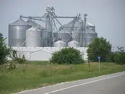 Grain Elevator along the tracks serving western Indiana farmers | |
 Location in Newton County | |
| Coordinates: 40°47′02″N 87°19′30″W / 40.78389°N 87.32500°W | |
| Country | |
| State | |
| County | Newton |
| Government | |
| • Type | Indiana township |
| Area | |
• Total | 35.52 sq mi (92.0 km2) |
| • Land | 35.52 sq mi (92.0 km2) |
| • Water | 0 sq mi (0 km2) 0% |
| Elevation | 682 ft (208 m) |
| Population (2020) | |
• Total | 1,100 |
| • Density | 31/sq mi (12/km2) |
| Time zone | UTC-6 (Central (CST)) |
| • Summer (DST) | UTC-5 (CDT) |
| ZIP codes | 47922, 47948, 47951 |
| Area code | 219 |
| GNIS feature ID | 453337 |
Grant Township is one of ten townships in Newton County, Indiana, United States. As of the 2020 census, its population was 1,100 and it contained 513 housing units.[2]
| Census | Pop. | Note | %± |
|---|---|---|---|
| 1890 | 1,624 | — | |
| 1900 | 1,716 | 5.7% | |
| 1910 | 1,762 | 2.7% | |
| 1920 | 1,734 | −1.6% | |
| 1930 | 1,585 | −8.6% | |
| 1940 | 1,656 | 4.5% | |
| 1950 | 1,702 | 2.8% | |
| 1960 | 1,716 | 0.8% | |
| 1970 | 1,570 | −8.5% | |
| 1980 | 1,567 | −0.2% | |
| 1990 | 1,341 | −14.4% | |
| 2000 | 1,293 | −3.6% | |
| 2010 | 1,189 | −8.0% | |
| 2020 | 1,100 | −7.5% | |
| Source: US Decennial Census[3] | |||
History
Grant Township was founded in 1865, and named for Ulysses S. Grant.[4]
Geography
According to the 2010 census, the township has a total area of 35.52 square miles (92.0 km2), all land.[5]
Cities, towns, villages
Unincorporated towns
(This list is based on USGS data and may include former settlements.)
Cemeteries
The township contains these two cemeteries: Goodland and Mount Calvary.
Major highways
Education
- South Newton School Corporation
Grant Township is served by the Goodland-Grant Township Public Library.[6]
Political districts
- Indiana's 1st congressional district
- State House District 15
- State Senate District 6
References
- "Grant Township, Newton County, Indiana". Geographic Names Information System. United States Geological Survey, United States Department of the Interior. Retrieved October 9, 2009.
- United States Census Bureau 2008 TIGER/Line Shapefiles
- IndianaMap
- ^ "US Board on Geographic Names". United States Geological Survey. October 25, 2007. Retrieved May 9, 2017.
- ^ "Explore Census Data". data.census.gov. Retrieved April 14, 2024.
- ^ "Township Census Counts: STATS Indiana".
- ^ A standard history of Jasper and Newton counties, Indiana. Lewis Publishing Company. 1916. p. 198.
- ^ "Population, Housing Units, Area, and Density: 2010 - County -- County Subdivision and Place -- 2010 Census Summary File 1". United States Census. Archived from the original on February 12, 2020. Retrieved May 10, 2013.
- ^ "Indiana public library directory" (PDF). Indiana State Library. Archived from the original (PDF) on February 18, 2017. Retrieved March 10, 2018.
External links
- Indiana Township Association
- United Township Association of Indiana
- City-Data.com page for Grant Township
Places adjacent to Grant Township, Newton County, Indiana | |
|---|---|
Municipalities and communities of Newton County, Indiana, United States | ||
|---|---|---|
| Towns |  | |
| Townships | ||
| CDPs | ||
| Other communities | ||
| Footnotes | ‡This populated place also has portions in an adjacent county or counties | |