Grayhawk, Missouri
Grayhawk, Missouri | |
|---|---|
 Grayhawk, Missouri  Grayhawk, Missouri | |
| Coordinates: 37°55′52″N 90°14′20″W / 37.93111°N 90.23889°W | |
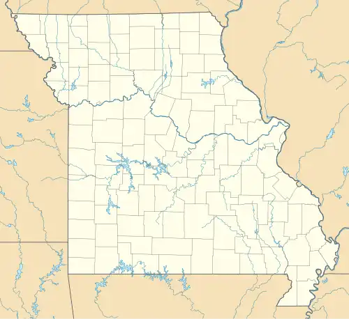
| Country | United States |
| State | Missouri |
| County | Ste. Genevieve |
| Area | |
• Total | 4.70 sq mi (12.18 km2) |
| • Land | 4.35 sq mi (11.27 km2) |
| • Water | 0.35 sq mi (0.90 km2) |
| Elevation | 692 ft (211 m) |
| Population (2020) | |
• Total | 488 |
| • Density | 112.11/sq mi (43.28/km2) |
| Time zone | UTC-6 (Central (CST)) |
| • Summer (DST) | UTC-5 (CDT) |
| Area code | 573 |
| GNIS feature ID | 2587075[2] |
Grayhawk is an unincorporated community and census-designated place in Ste. Genevieve County, Missouri, United States. Its population was 525 as of the 2010 census.[3]
Geography
According to the U.S. Census Bureau, the community has an area of 4.701 square miles (12.18 km2); 4.353 square miles (11.27 km2) of its area is land, and 0.348 square miles (0.90 km2) is water.[3]
Demographics
| Census | Pop. | Note | %± |
|---|---|---|---|
| 2020 | 488 | — | |
| U.S. Decennial Census[4] | |||
References
- ^ "ArcGIS REST Services Directory". United States Census Bureau. Retrieved August 28, 2022.
- ^ "Grayhawk Census Designated Place". Geographic Names Information System. United States Geological Survey, United States Department of the Interior.
- ^ a b "2010 Census Gazetteer Files - Places: Missouri". U.S. Census Bureau. Retrieved January 19, 2017.
- ^ "Census of Population and Housing". Census.gov. Retrieved June 4, 2016.
Municipalities and communities of Sainte Genevieve County, Missouri, United States | ||
|---|---|---|
| Cities | 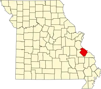 | |
| Townships | ||
| CDPs | ||
| Other communities | ||
| Ghost towns | ||
| Footnotes | ‡This populated place also has portions in an adjacent county or counties | |