Grizzly Mountain (Montana)
| Grizzly Mountain | |
|---|---|
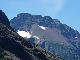 Grizzly Mountain as seen from Two Medicine Lake | |
| Highest point | |
| Elevation | 9,072 ft (2,765 m)[1] |
| Prominence | 1,707 ft (520 m)[1] |
| Coordinates | 48°25′07″N 113°24′07″W / 48.4185767°N 113.4020435°W[2] |
| Geography | |
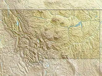 Grizzly Mountain Location in Montana  Grizzly Mountain Location in the United States | |
| Location | Glacier County, Montana, Flathead County, Montana, U.S. |
| Parent range | Lewis Range |
| Topo map | USGS Mount Rockwell |
| Climbing | |
| Easiest route | Scramble |
Grizzly Mountain (9,072 feet (2,765 m)) is located in the Lewis Range, Glacier National Park in the U.S. state of Montana.[3] Grizzly Mountain sits astride the Continental Divide in the Two Medicine region of Glacier National Park.
See also
References
- ^ a b "Grizzly Mountain, Montana". Peakbagger.com. Retrieved August 2, 2017.
- ^ "Grizzly Mountain". Geographic Names Information System. United States Geological Survey, United States Department of the Interior. Retrieved August 2, 2017.
- ^ Mount Rockwell, MT (Map). TopoQwest (United States Geological Survey Maps). Retrieved August 2, 2017.
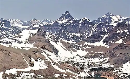
Red Crow Mountain (lower left), and Mount Rockwell (upper right).
Camera pointed northwest.