Hart, North Dakota
Hart, North Dakota | |
|---|---|
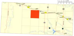 Location of Hart | |
| Coordinates: 46°09′44″N 103°33′23″W / 46.16222°N 103.55639°W | |
| Country | United States |
| State | North Dakota |
| County | Bowman |
| Elevation | 3,133 ft (955 m) |
| Population (2010) | |
• Total | 25 |
| Time zone | UTC-7 (Mountain (MST)) |
| • Summer (DST) | UTC-6 (MDT) |
| Area code | 701 |
| GNIS feature ID | 1036082[1] |
Hart is an unorganized territory in Bowman County in the U.S. state of North Dakota. As of the 2010 census, its population was 25.[2]
References
- ^ a b U.S. Geological Survey Geographic Names Information System: Hart, North Dakota
- ^ "Geographic Identifiers: 2010 Demographic Profile Data (G001): Hart UT, Bowman County, North Dakota". U.S. Census Bureau, American Factfinder. Archived from the original on February 12, 2020. Retrieved August 13, 2016.
Municipalities and communities of Bowman County, North Dakota, United States | ||
|---|---|---|
| Cities | 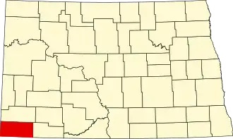 | |
| Townships | ||
| Unorganized territories | ||
| Unincorporated community | ||