Hawleyville, Iowa
Hawleyville, Iowa | |
|---|---|
Extinct Hamlet | |
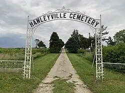 Hawleyville Cemetery in Nebraska Township | |
 Hawleyville, Iowa | |
| Coordinates: 40°46′36″N 94°56′11″W / 40.77667°N 94.93639°W | |
| Country | United States |
| State | Iowa |
| County | Page, Taylor |
| Elevation | 1,027 ft (313 m) |
| Time zone | UTC-6 (Central (CST)) |
| • Summer (DST) | UTC-5 (CDT) |
| Area code | 712 |
| GNIS feature ID | 457336[1] |
Hawleyville is an extinct hamlet in Page and Taylor counties in the U.S. state of Iowa.[1] The Page County portion of the community is in Nebraska Township, while the Taylor County portion is in Dallas Township.[2] Hawleyville is located along County Route J31, 5.9 miles (9.5 km) east-northeast of Clarinda.[3]
History
Hawleyville was platted in 1853, and named after James Hawley, a local merchant.[4] Hawleyville's population was 82 in 1902.[5]
References
- ^ a b "Hawleyville". Geographic Names Information System. United States Geological Survey, United States Department of the Interior.
- ^ Andreas, Alfred Theodore. "Illustrated historical atlas of the state of Iowa, 1875". Iowa Digital Library. S. Augustus Mitchell 1860. Retrieved August 5, 2025.
- ^ "Page County, Iowa Highway and Transportation Map" (PDF). Iowa Department of Transportation. January 1, 2017. Archived (PDF) from the original on April 28, 2018. Retrieved July 14, 2018.
- ^ Biographical History of Page County, Iowa. Lewis & Dunbar. 1890. p. 355.
- ^ Cram's Modern Atlas: The New Unrivaled New Census Edition. J. R. Gray & Company. 1902. pp. 203–207.
Municipalities and communities of Page County, Iowa, United States | ||
|---|---|---|
| Cities |  | |
| Townships | ||
| Unincorporated communities | ||
| Footnotes | ‡This populated place also has portions in an adjacent county or counties | |
Municipalities and communities of Taylor County, Iowa, United States | ||
|---|---|---|
| Cities | 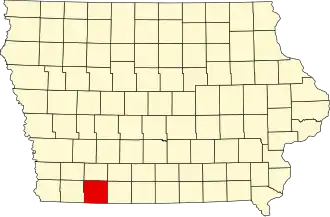 | |
| Townships | ||
| CDP | ||
| Unincorporated communities | ||
| Footnotes | ‡This populated place also has portions in an adjacent county or counties | |