Headquarters, Idaho
Headquarters, Idaho | |
|---|---|
 Headquarters, Idaho  Headquarters, Idaho | |
| Coordinates: 46°37′48″N 115°48′34″W / 46.63000°N 115.80944°W | |
| Country | United States |
| State | Idaho |
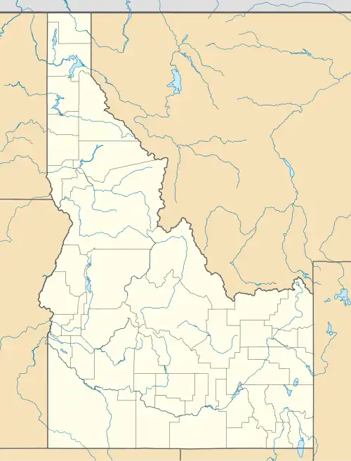
| County | Clearwater |
| Elevation | 3,160 ft (960 m) |
| Time zone | UTC-8 (Pacific (PST)) |
| • Summer (DST) | UTC-7 (PDT) |
| Area codes | 208, 986 |
| GNIS feature ID | 396638[1] |
Headquarters is an unincorporated community in Clearwater County, Idaho, United States. Headquarters is located on State Highway 11, 10 miles (16 km) north of Pierce.
History
A company town of Potlatch Corp., it was originally established as a fire protection station in 1906.[2] Headquarters was the northeastern terminus of the Camas Prairie Railroad.
Headquarters' population was estimated at 300 in 1960.[3]
The closure of lumber mills in the area in the 1980s and 1990s eliminated many jobs and severely impacted its population.[4][5][6]
Climate
According to the Köppen climate classification system, Grangeville qualifies as having a dry-summer humid continental climate (Köppen Dsb).
| Climate data for Headquarters, Idaho 1991–2020 normals, 1959-2020 extremes: 3200ft (975m) | |||||||||||||
|---|---|---|---|---|---|---|---|---|---|---|---|---|---|
| Month | Jan | Feb | Mar | Apr | May | Jun | Jul | Aug | Sep | Oct | Nov | Dec | Year |
| Record high °F (°C) | 55 (13) |
64 (18) |
72 (22) |
88 (31) |
97 (36) |
97 (36) |
102 (39) |
108 (42) |
99 (37) |
85 (29) |
69 (21) |
55 (13) |
108 (42) |
| Mean maximum °F (°C) | 46.2 (7.9) |
53.0 (11.7) |
62.1 (16.7) |
74.5 (23.6) |
82.5 (28.1) |
89.0 (31.7) |
93.0 (33.9) |
93.8 (34.3) |
88.3 (31.3) |
75.2 (24.0) |
55.9 (13.3) |
44.3 (6.8) |
93.8 (34.3) |
| Mean daily maximum °F (°C) | 35.0 (1.7) |
39.4 (4.1) |
45.5 (7.5) |
52.4 (11.3) |
63.2 (17.3) |
69.7 (20.9) |
80.1 (26.7) |
79.6 (26.4) |
70.3 (21.3) |
55.5 (13.1) |
41.6 (5.3) |
33.2 (0.7) |
55.5 (13.0) |
| Daily mean °F (°C) | 26.7 (−2.9) |
29.9 (−1.2) |
34.3 (1.3) |
39.5 (4.2) |
48.6 (9.2) |
55.0 (12.8) |
62.0 (16.7) |
60.6 (15.9) |
52.6 (11.4) |
41.8 (5.4) |
33.2 (0.7) |
26.4 (−3.1) |
42.6 (5.9) |
| Mean daily minimum °F (°C) | 18.5 (−7.5) |
20.3 (−6.5) |
23.1 (−4.9) |
26.5 (−3.1) |
33.9 (1.1) |
40.3 (4.6) |
44.0 (6.7) |
41.5 (5.3) |
35.0 (1.7) |
28.1 (−2.2) |
24.7 (−4.1) |
19.6 (−6.9) |
29.6 (−1.3) |
| Mean minimum °F (°C) | −1.9 (−18.8) |
3.3 (−15.9) |
12.1 (−11.1) |
21.1 (−6.1) |
25.0 (−3.9) |
31.8 (−0.1) |
36.4 (2.4) |
35.2 (1.8) |
26.5 (−3.1) |
18.6 (−7.4) |
10.6 (−11.9) |
−0.1 (−17.8) |
−9.1 (−22.8) |
| Record low °F (°C) | −27 (−33) |
−21 (−29) |
−11 (−24) |
4 (−16) |
19 (−7) |
25 (−4) |
26 (−3) |
28 (−2) |
18 (−8) |
1 (−17) |
−22 (−30) |
−28 (−33) |
−28 (−33) |
| Average precipitation inches (mm) | 4.75 (121) |
4.17 (106) |
4.57 (116) |
3.66 (93) |
3.49 (89) |
2.66 (68) |
0.90 (23) |
1.03 (26) |
1.43 (36) |
3.42 (87) |
5.23 (133) |
5.58 (142) |
40.89 (1,040) |
| Average snowfall inches (cm) | 32.80 (83.3) |
16.60 (42.2) |
16.50 (41.9) |
4.20 (10.7) |
0.80 (2.0) |
0.00 (0.00) |
0.00 (0.00) |
0.00 (0.00) |
0.00 (0.00) |
0.20 (0.51) |
16.00 (40.6) |
31.60 (80.3) |
118.7 (301.51) |
| Source 1: NOAA[7] | |||||||||||||
| Source 2: XMACIS2 (temp records & 1981-2010 monthly max/mins)[8] | |||||||||||||
| Climate data for Headquarters (1959-2010) | |||||||||||||
|---|---|---|---|---|---|---|---|---|---|---|---|---|---|
| Month | Jan | Feb | Mar | Apr | May | Jun | Jul | Aug | Sep | Oct | Nov | Dec | Year |
| Record high °F (°C) | 55 (13) |
64 (18) |
72 (22) |
88 (31) |
97 (36) |
97 (36) |
102 (39) |
108 (42) |
99 (37) |
85 (29) |
69 (21) |
55 (13) |
108 (42) |
| Mean daily maximum °F (°C) | 35 (2) |
39.9 (4.4) |
45.2 (7.3) |
53.1 (11.7) |
62.8 (17.1) |
70.9 (21.6) |
80.8 (27.1) |
80.6 (27.0) |
70.4 (21.3) |
57 (14) |
42.6 (5.9) |
34.3 (1.3) |
56.1 (13.4) |
| Mean daily minimum °F (°C) | 18.8 (−7.3) |
19.6 (−6.9) |
23.3 (−4.8) |
28.7 (−1.8) |
34.9 (1.6) |
42 (6) |
45.1 (7.3) |
43.4 (6.3) |
36.5 (2.5) |
29.9 (−1.2) |
25.2 (−3.8) |
19.3 (−7.1) |
30.6 (−0.8) |
| Record low °F (°C) | −27 (−33) |
−24 (−31) |
−11 (−24) |
4 (−16) |
19 (−7) |
25 (−4) |
26 (−3) |
28 (−2) |
18 (−8) |
1 (−17) |
−5 (−21) |
−28 (−33) |
−28 (−33) |
| Average precipitation inches (mm) | 5.41 (137) |
3.79 (96) |
3.94 (100) |
3.26 (83) |
3.26 (83) |
2.53 (64) |
1.06 (27) |
1.24 (31) |
1.69 (43) |
3 (76) |
5.15 (131) |
5.4 (140) |
39.74 (1,009) |
| Average snowfall inches (cm) | 29.9 (76) |
15.9 (40) |
13 (33) |
4 (10) |
0.4 (1.0) |
0 (0) |
0 (0) |
0 (0) |
0 (0) |
0.6 (1.5) |
14.1 (36) |
28.6 (73) |
106.5 (271) |
| Average precipitation days | 17 | 14 | 15 | 14 | 13 | 11 | 5 | 5 | 7 | 10 | 16 | 17 | 144 |
| Source: WRCC[9] | |||||||||||||
References
- ^ a b U.S. Geological Survey Geographic Names Information System: Headquarters, Idaho
- ^ "Company town began as fire headquarters". Lewiston Morning Tribune. October 6, 1955. p. 6.
- ^ World Book Encyclopedia. Vol. I. Field Enterprises Corporation. 1960. p. 27.
- ^ Ripley, Richard (August 25, 1985). "Logging town's existence threatened". Spokesman-Review. p. B1.
- ^ Viden, Paul (February 25, 1992). "Potlatch saves 59 logging jobs". Moscow-Pullman Daily News. p. 12A.
- ^ Free, Cathy (May 27, 1992). "It's hard to go after the good life in Idaho logging town". Spokesman-Review. p. B1.
- ^ "Headquarters, Idaho 1991-2020 Monthly Normals". Retrieved January 11, 2024.
- ^ "xmACIS". National Oceanic and Atmospheric Administration. Retrieved January 11, 2024.
- ^ "HEADQUARTERS, ID (104150)". Western Regional Climate Center. Retrieved November 26, 2015.
Municipalities and communities of Clearwater County, Idaho, United States | ||
|---|---|---|
| Cities | ||
| Unincorporated communities | ||
| Indian reservation | ||
| Footnotes | ‡This populated place also has portions in an adjacent county or counties | |