Heng, Rogaland
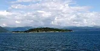 View of the island | |
| Geography | |
|---|---|
| Location | Rogaland, Norway |
| Coordinates | 59°01′14″N 5°53′38″E / 59.0206°N 5.8939°E |
| Area | 0.6 km2 (0.23 sq mi) |
| Length | 1.3 km (0.81 mi) |
| Width | 800 m (2600 ft) |
| Highest elevation | 53 m (174 ft) |
| Highest point | Høgabakka |
| Administration | |
| County | Rogaland |
| Municipality | Strand |
Heng is a small island in the Strand municipality of Rogaland, Norway.[1] The 0.6-square-kilometre (150-acre) island lies in the Idsefjorden, about 3 kilometres (1.9 mi) southwest of the village of Tau on the mainland. Heng lies roughly halfway between the islands of Hidle and Idse.
See also
References
- ^ "Heng, Strand (Rogaland)" (in Norwegian). yr.no. Retrieved 2016-02-03.