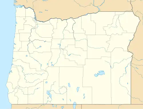
Hereford, Oregon
Hereford, Oregon | |
|---|---|
 Hereford, Oregon  Hereford, Oregon | |
| Coordinates: 44°29′55″N 118°02′14″W / 44.49861°N 118.03722°W | |
| Country | United States |
| State | Oregon |
| County | Baker |
| Elevation | 3,671 ft (1,119 m) |
| Time zone | UTC-8 (Pacific (PST)) |
| • Summer (DST) | UTC-7 (PDT) |
| Area codes | 458 and 541 |
| GNIS feature ID | 1136373[1] |
Hereford is an unincorporated community in Baker County, in the U.S. state of Oregon.[1] Hereford lies along the Burnt River southwest of Baker.[2] It is on Oregon Route 245 northeast of its intersection with U.S. Route 26 in Unity.[2] Hereford is 3,671 feet (1,119 m) above sea level.[1]
Hereford once had a post office, but the area continues to use a ZIP code 97837.[3] It is said that the community was named in the late 19th century for a Hereford bull.[4] A post office was established here on March 7, 1887.[4]
References
- ^ a b c "Hereford". Geographic Names Information System. United States Geological Survey. November 28, 1980. Retrieved November 18, 2016.
- ^ a b Oregon Atlas & Gazetteer (7th ed.). Yarmouth, Maine: DeLorme. 2008. p. 79. ISBN 0-89933-347-8.
- ^ "Search Results for Hereford, Oregon". CD Light. Retrieved November 18, 2016.
- ^ a b McArthur, Lewis A.; McArthur, Lewis L. (2003) [1928]. Oregon Geographic Names (7th ed.). Portland, Oregon: Oregon Historical Society Press. p. 464. ISBN 978-0875952772.
External links
- Photos of Hereford by Richard Bauer
Municipalities and communities of Baker County, Oregon, United States | ||
|---|---|---|
| Cities | 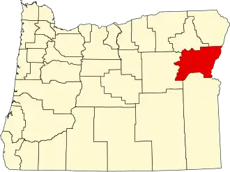 | |
| Unincorporated communities | ||
| Ghost towns | ||
| Footnotes |
| |