High Dyke, County Durham
| High Dyke | |
|---|---|
 | |
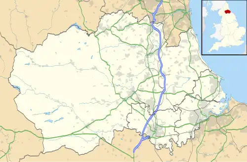 High Dyke Location within County Durham | |
| OS grid reference | NY949262 |
| Civil parish | |
| Unitary authority | |
| Ceremonial county | |
| Region | |
| Country | England |
| Sovereign state | United Kingdom |
| Post town | Darlington |
| Postcode district | DL12 |
| Police | Durham |
| Fire | County Durham and Darlington |
| Ambulance | North East |
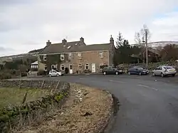
High Dyke is a hamlet[1] in County Durham, England. It is a short distance to the north of Middleton-in-Teesdale and within the civil parish of the same name.[2] It is named High Dike on an Ordnance Survey map published in 1920 and lies on and around the 1,000 feet (300 m) contour line.[3] Silver-lead ore was mined here in the 19th-century by the London Lead Company;[4] several old shafts are marked on the map.
References
- ^ "Ordnance Survey Open Data Names Download (NY82)". Ordnance Survey Data Hub. Ordnance Survey. Retrieved 2 January 2025.
- ^ "Election Maps". www.ordnancesurvey.co.uk. Retrieved 2 January 2025.
- ^ "View map: Ordnance Survey, Yorkshire II.SE & IIA.SW (includes: Eggleston; Holwick; Middleton in Teesdale.) - Ordnance Survey Six-inch England and Wales, 1842-1952". maps.nls.uk. Retrieved 2 January 2025.
- ^ Hunt, Robert (1877). Memoirs of the Geological Survey of Great Britain and of the Museum of Practical Geology: Mining records. Mineral statistics of the United Kingdom of Great Britain and Ireland ... Longmans, Green & Co. p. 161.