Hořátev
Hořátev | |
|---|---|
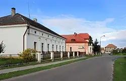 Eastern part of Hořátev | |
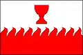 Flag 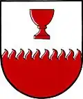 Coat of arms | |
 Hořátev Location in the Czech Republic | |
| Coordinates: 50°8′59″N 15°2′24″E / 50.14972°N 15.04000°E | |
| Country | |
| Region | Central Bohemian |
| District | Nymburk |
| First mentioned | 1384 |
| Area | |
• Total | 7.15 km2 (2.76 sq mi) |
| Elevation | 186 m (610 ft) |
| Population (2025-01-01)[1] | |
• Total | 799 |
| • Density | 110/km2 (290/sq mi) |
| Time zone | UTC+1 (CET) |
| • Summer (DST) | UTC+2 (CEST) |
| Postal code | 289 13 |
| Website | www |
Hořátev is a municipality and village in Nymburk District in the Central Bohemian Region of the Czech Republic. It has about 800 inhabitants.
History
The first written mention of Hořátev is from 1384.[2]
Demographics
| Year | Pop. | ±% |
|---|---|---|
| 1869 | 448 | — |
| 1880 | 489 | +9.2% |
| 1890 | 545 | +11.5% |
| 1900 | 514 | −5.7% |
| 1910 | 554 | +7.8% |
| 1921 | 682 | +23.1% |
| 1930 | 721 | +5.7% |
| 1950 | 659 | −8.6% |
| 1961 | 679 | +3.0% |
| 1970 | 642 | −5.4% |
| 1980 | 615 | −4.2% |
| 1991 | 527 | −14.3% |
| 2001 | 611 | +15.9% |
| 2011 | 747 | +22.3% |
| 2021 | 795 | +6.4% |
| Source: Censuses[3][4] | ||
References
- ^ "Population of Municipalities – 1 January 2025". Czech Statistical Office. 2025-05-16.
- ^ "Obec Hořátev" (in Czech). Obec Hořátev. Retrieved 2022-08-23.
- ^ "Historický lexikon obcí České republiky 1869–2011" (in Czech). Czech Statistical Office. 2015-12-21.
- ^ "Population Census 2021: Population by sex". Public Database. Czech Statistical Office. 2021-03-27.
External links
Wikimedia Commons has media related to Hořátev.