Hohenau an der Raab
Hohenau an der Raab | |
|---|---|
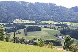 Haufenreith (part of Hohenau) | |
 Coat of arms | |
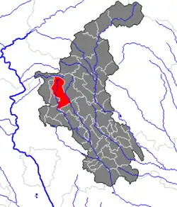 Location within Weiz district | |
 Hohenau an der Raab Location within Austria | |
| Coordinates: 47°18′00″N 15°33′00″E / 47.30000°N 15.55000°E | |
| Country | Austria |
| State | Styria |
| District | Weiz |
| Area | |
• Total | 37.8 km2 (14.6 sq mi) |
| Elevation | 680 m (2,230 ft) |
| Population (1 January 2016)[1] | |
• Total | 1,331 |
| • Density | 35/km2 (91/sq mi) |
| Time zone | UTC+1 (CET) |
| • Summer (DST) | UTC+2 (CEST) |
| Postal code | 8162 |
| Area code | 03179 |
| Vehicle registration | WZ |
| Website | www.hohenau-raab.steiermark.at |
Hohenau an der Raab is a former municipality in the district of Weiz in the Austrian state of Styria. Since the 2015 Styria municipal structural reform, it is part of the municipality Passail.[2]
Geography
Hohenau an der Raab is located in the east of Styria.
The highest point is the Siebenkögel at 1409 m in the north.
Places adjacent to Hohenau an der Raab | |
|---|---|
References