Hohenfelden
Hohenfelden | |
|---|---|
Location of Hohenfelden within Weimarer Land district 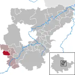 | |
 Hohenfelden  Hohenfelden | |
| Coordinates: 50°52′43″N 11°9′39″E / 50.87861°N 11.16083°E | |
| Country | Germany |
| State | Thuringia |
| District | Weimarer Land |
| Municipal assoc. | Kranichfeld |
| Government | |
| • Mayor (2020–26) | Thomas Morche[1] |
| Area | |
• Total | 8.43 km2 (3.25 sq mi) |
| Elevation | 328 m (1,076 ft) |
| Population (2024-12-31)[2] | |
• Total | 374 |
| • Density | 44/km2 (110/sq mi) |
| Time zone | UTC+01:00 (CET) |
| • Summer (DST) | UTC+02:00 (CEST) |
| Postal codes | 99448 |
| Dialling codes | 036450 |
| Vehicle registration | AP |
| Website | hohenfelden.de |
Hohenfelden is a municipality in the Weimarer Land district of Thuringia, Germany.
History
Within the German Empire (1871–1918), the northern part of Hohenfelden belonged to the Grand Duchy of Saxe-Weimar-Eisenach, while the southern part belonged to the Duchy of Saxe-Meiningen.
References
- ^ Gewählte Bürgermeister - aktuelle Landesübersicht, Freistaat Thüringen, accessed 14 July 2021.
- ^ "Bevölkerung der Gemeinden vom Thüringer Landesamt für Statistik" (in German). Thüringer Landesamt für Statistik.