Horfield, Victoria
| Horfield Victoria | |
|---|---|
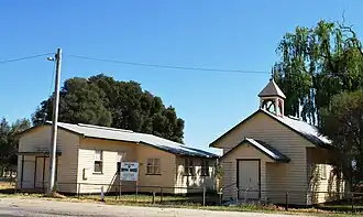 Uniting church and hall, 2008 | |
 Horfield | |
| Coordinates | 35°52′48″S 144°13′18″E / 35.88000°S 144.22167°E |
| Population | 91 (2016 census)[1] |
| Postcode(s) | 3567 |
| Location | |
| LGA(s) | |
| State electorate(s) | Murray Plains |
| Federal division(s) | Mallee |
Horfield is a locality in the Shire of Gannawarra and the Shire of Loddon, Victoria, Australia, 267 kilometres (166 mi) north west of the state capital, Melbourne. At the 2016 census, Horfield had a population of 91.[1]
References
- ^ a b Australian Bureau of Statistics (27 June 2017). "Horfield". 2016 Census QuickStats. Retrieved 2 August 2017.
External links
![]() Media related to Horfield, Victoria at Wikimedia Commons
Media related to Horfield, Victoria at Wikimedia Commons
Localities in the Shire of Gannawarra | ||
|---|---|---|
| Town | | |
| Locality |
| |
^ - Territory divided with another LGA | ||
Towns and localities in the Shire of Loddon | ||
|---|---|---|
| Town |  | |
| Locality |
| |
^ - Territory divided with another LGA | ||