Hremiach
Hremiach
Грем'яч | |
|---|---|
Village | |
 Seal | |
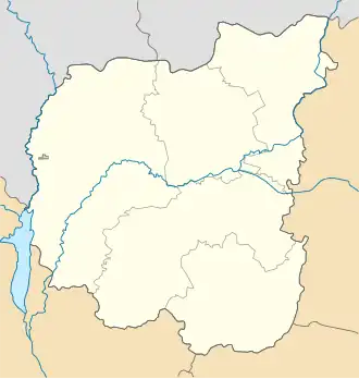 Hremiach Location of Hremiach 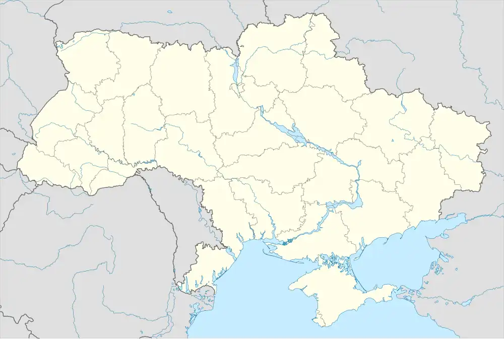 Hremiach Hremiach (Ukraine) | |
| Coordinates: 52°20′04″N 33°17′19″E / 52.33444°N 33.28861°E | |
| Country | |
| Oblast | Chernihiv Oblast |
| Raion | Novhorod-Siverskyi Raion |
| Founded | 1604 |
| Area | |
• Total | 5.57 km2 (2.15 sq mi) |
| Elevation | 145 m (476 ft) |
| Population | |
• Total | 1,399 |
| • Density | 250/km2 (650/sq mi) |
| Time zone | UTC+2 (EET) |
| • Summer (DST) | UTC+3 (EEST) |
| Postal code | 16020 |
| Area code | +380 4658 |
Hremiach (Ukrainian: Грем'яч) is a village in Novhorod-Siverskyi Raion, Chernihiv Oblast, northern Ukraine. The village is the northernmost point of Ukraine.[1] It belongs to Novhorod-Siverskyi urban hromada, one of the hromadas of Ukraine.[2]
On November 15, 2024, Russian Forces crossed the border seized the villages of Muravi, Novoselivka and Kolos and planted a Russian flag on the outskirts of Hremiach before retreating.[3] By the next day the flags had been dismantled by Ukrainian forces.[4]
References
- ^ Ф.Д.Заставный. Физическая география. 8 класс. Харьков
- ^ "Новгород-Северская городская громада" (in Russian). Портал об'єднаних громад України.
- ^ Mappes, Grace; Gasparyan, Davit; Hird, Karolina; Evans, Angelica; Gibson, Olivia; Trotter, Nate; Runkel, William; Barros, George. "Russian Offensive Campaign Assessment, November 15, 2024". Institute for the Study of War. Retrieved 19 November 2024.
- ^ Evans, Angelica; Harward, Christina; Mappes, Grace; Trotter, Nate; Kagan, Frederick W. "Russian Offensive Campaign Assessment, November 16, 2024". Institute for the Study of War. Retrieved 19 November 2024.