Huby, Hambleton
| Huby | |
|---|---|
 | |
.svg.png) Huby Location within North Yorkshire | |
| Population | 1,167 (2011 census)[1] |
| OS grid reference | SE567658 |
| Civil parish |
|
| Unitary authority | |
| Ceremonial county | |
| Region | |
| Country | England |
| Sovereign state | United Kingdom |
| Post town | YORK |
| Postcode district | YO61 |
| Dialling code | 01347 |
| Police | North Yorkshire |
| Fire | North Yorkshire |
| Ambulance | Yorkshire |
| UK Parliament | |
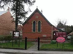
Huby is a village and civil parish in the county of North Yorkshire, England, about nine and a half miles north of York and five miles south-east of Easingwold.[2] The village has a small shop, post office, fish and chip shop, a Chinese takeaway, a pub, motel rooms, a Methodist church, a sports ground complete with a pavilion, a B&B motel and a village hall.[3]
Governance
Huby is the largest village in the electoral ward of Huby and Sutton. The population of this ward at the 2011 census was 1,940.[4]
From 1974 to 2023 it was part of the district of Hambleton, it is now administered by the unitary North Yorkshire Council.
See also
References
- ^ UK Census (2011). "Local Area Report – Huby Parish (1170216859)". Nomis. Office for National Statistics. Retrieved 27 April 2018.
- ^ Ordnance Survey: Landranger map sheet 100 Malton & Pickering (Helmsley & Easingwold) (Map). Ordnance Survey. 2012. ISBN 9780319231203.
- ^ "Visit Easingwold - Huby". www.visit-easingwold.com. Retrieved 3 April 2016.
- ^ UK Census (2011). "Local Area Report – Huby and Sutton Ward (as of 2011) (E05006216)". Nomis. Office for National Statistics. Retrieved 23 September 2022.
External links
![]() Media related to Huby, Hambleton at Wikimedia Commons
Media related to Huby, Hambleton at Wikimedia Commons
- Huby village website - general information on the village