Inva
| Inva | |
|---|---|
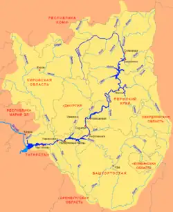 Scheme of the Kama River Basin. | |
| Location | |
| Country | Russia |
| Physical characteristics | |
| Source | |
| • location | Upper Kama Upland |
| Mouth | |
• location | Kama |
• coordinates | 58°59′54″N 55°52′13″E / 58.99833°N 55.87028°E |
| Length | 257 km (160 mi) |
| Basin size | 5,920 km2 (2,290 sq mi) |
| Basin features | |
| Progression | Kama→ Volga→ Caspian Sea |
The Inva (Russian: Иньва) is a river in Perm Krai, Russia, a right tributary of the river Kama.[1] It begins in the Upper Kama Upland near the border of Kirov oblast then flows through Komi-Permyak Okrug and into Kama Reservoir, forming Invensky Bay. The main tributaries are Velva and Kuva (left), Yusva (right).
The river is 257 kilometres (160 mi) long with a drainage basin of 5,920 square kilometres (2,290 sq mi).[2] It is frozen from early November to late April. The town of Kudymkar is along the Inva River.
Etymology
The name of the river is formed from the Komi-Permyak words “инь” (woman) and “ва” (water), which can be translated as “female water”.
References
- ^ Inva in encyclopedia of Perm Krai
- ^ «Река ИНЬВА», Russian State Water Registry
External links