Rural Municipality of Invermay No. 305
Invermay No. 305 | |
|---|---|
| Rural Municipality of Invermay No. 305 | |
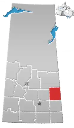
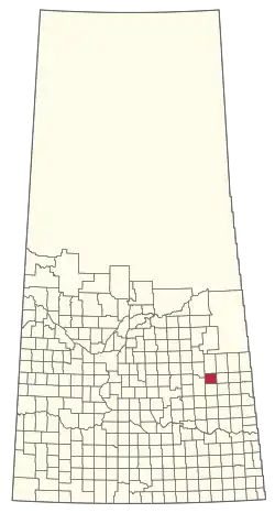 Location of the RM of Invermay No. 305 in Saskatchewan | |
| Coordinates: 51°45′40″N 103°03′58″W / 51.761°N 103.066°W[1] | |
| Country | Canada |
| Province | Saskatchewan |
| Census division | 9 |
| SARM division | 4 |
| Formed[2] | December 11, 1911 |
| Government | |
| • Reeve | Bev Whyatt |
| • Governing body | RM of Invermay No. 305 Council |
| • Administrator | Dana Jack |
| • Office location | Invermay |
| Area (2016)[4] | |
| • Land | 729.44 km2 (281.64 sq mi) |
| Population (2016)[4] | |
• Total | 325 |
| • Density | 0.4/km2 (1/sq mi) |
| Time zone | CST |
| • Summer (DST) | CST |
| Area codes | 306 and 639 |
The Rural Municipality of Invermay No. 305 (2016 population: 325) is a rural municipality (RM) in the Canadian province of Saskatchewan within Census Division No. 9 and SARM Division No. 4.
History
The RM of Invermay No. 305 incorporated as a rural municipality on December 11, 1911.[2]
Geography
The following rivers, lakes and streams are located in the RM.
- Rivers and lakes
- Whitesand River
- Stonewall Lake
- Saline Lake
- Dog Lake
- Newburn Lake
- Silver Lake
- Woody Lake
- Creeks and streams
- Spirit Creek
- Conjuring Creek
Geography
Communities and localities
The following urban municipalities are surrounded by the RM.
The following unincorporated communities are within the RM.
- Localities
- Dobrowody
- Dernic
- Netherton
- Lone Spruce
- Mitchellview
Demographics
In the 2021 Census of Population conducted by Statistics Canada, the RM of Invermay No. 305 had a population of 269 living in 110 of its 133 total private dwellings, a change of -17.2% from its 2016 population of 325. With a land area of 694.14 km2 (268.01 sq mi), it had a population density of 0.4/km2 (1.0/sq mi) in 2021.[7]
In the 2016 Census of Population, the RM of Invermay No. 305 recorded a population of 325 living in 129 of its 156 total private dwellings, a -2.7% change from its 2011 population of 334. With a land area of 729.44 km2 (281.64 sq mi), it had a population density of 0.4/km2 (1.2/sq mi) in 2016.[4]
Attractions
- Grotto of our Lady of Lourdes in Rama
- The Invermay Fair
Government
The RM of Invermay No. 305 is governed by an elected municipal council and an appointed administrator that meets on the second Wednesday of every month.[3] The reeve of the RM is Bev Whyatt while its administrator is Dana Jack.[3] The RM's office is located in Invermay.[3]
Transportation
See also
References
- ^ "Pre-packaged CSV files - CGN, Canada/Province/Territory (cgn_sk_csv_eng.zip)". Government of Canada. July 24, 2019. Retrieved May 23, 2020.
- ^ a b "Rural Municipality Incorporations (Alphabetical)". Saskatchewan Ministry of Municipal Affairs. Archived from the original on April 21, 2011. Retrieved May 9, 2020.
- ^ a b c d "Municipality Details: RM of Invermay No. 305". Government of Saskatchewan. Retrieved May 21, 2020.
- ^ a b c "Population and dwelling counts, for Canada, provinces and territories, and census subdivisions (municipalities), 2016 and 2011 censuses – 100% data (Saskatchewan)". Statistics Canada. February 8, 2017. Retrieved May 1, 2020.
- ^ "Saskatchewan Census Population" (PDF). Saskatchewan Bureau of Statistics. Archived from the original (PDF) on September 24, 2015. Retrieved May 9, 2020.
- ^ "Saskatchewan Census Population". Saskatchewan Bureau of Statistics. Retrieved May 9, 2020.
- ^ "Population and dwelling counts: Canada, provinces and territories, census divisions and census subdivisions (municipalities), Saskatchewan". Statistics Canada. February 9, 2022. Retrieved April 13, 2022.