List of Interstate Highways in Iowa
| Interstate Highways of the Iowa Primary Highway System | |
|---|---|
.svg.png) .svg.png)  Highway markers for I-80, I-380, and I-35 Bus. Loop | |
Interstate Highways in Iowa highlighted in red | |
| System information | |
| Formed | August 14, 1957[1] |
| Highway names | |
| Interstates | Interstate X (I-X) |
| Business Loops: | Interstate X Business (I-X Bus.) |
| System links | |
Interstate Highways in Iowa form a network of freeways that cross the U.S. state of Iowa as part of the Interstate Highway System.
Primary Interstates
| Number | Length (mi)[2] | Length (km) | Southern or western terminus | Northern or eastern terminus | Formed | Removed | ||
|---|---|---|---|---|---|---|---|---|
| 151.941 | 244.525 | I-29 at Hamburg | I-29 at Sioux City | 1958 | current | |||
| 218.532 | 351.693 | I-35 near Lamoni | I-35 near Albert Lea, Minn. | 1958 | current | |||
| 5.399 | 8.689 | I-80 at Davenport | I-74 / US 6 at Bettendorf | 1968 | current | |||
| 306.392 | 493.090 | I-80 at Council Bluffs | I-80 at LeClaire | 1958 | current | |||
- Primary Interstates
-
 I-29 as viewed from the Sergeant Floyd Monument
 -
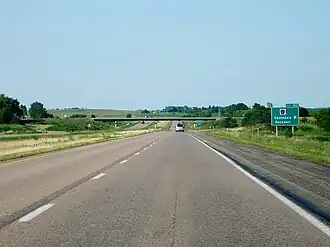 I-35 approaching exit 182
 -
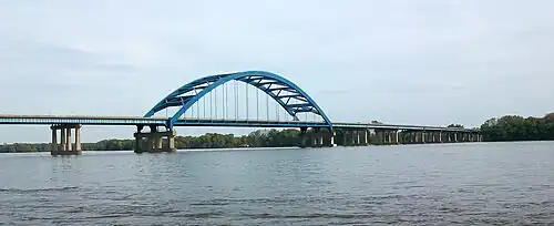
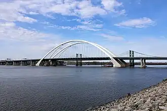 The Interstate 74 Bridge carrying I-74 across the Mississippi River
 -
 I-80 in western Iowa near Walnut
 -
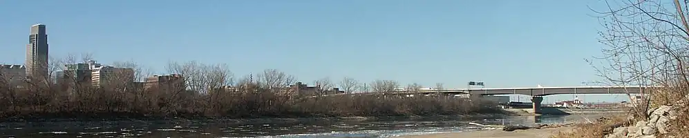
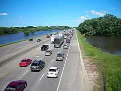 Traffic congestion on I‑35 / I‑80 during the Iowa flood of 2008
Auxiliary Interstates
| Number | Length (mi)[2] | Length (km) | Southern or western terminus | Northern or eastern terminus | Formed | Removed | Notes | |
|---|---|---|---|---|---|---|---|---|
| 17.102 | 27.523 | I-29 at Loveland | I-80 near Neola | 1966 | 1973 | Replaced by I-680; now I-880 | ||
| 0.286 | 0.460 | I-129 / US 20 / US 75 at Sioux City | I-29 / US 20 / US 75 at Sioux City | 1976 | current | |||
| 14.585 | 23.472 | I-35 / I-80 at West Des Moines | I-35 / I-80 at Des Moines | 1961 | current | |||
| 9.862 | 15.871 | I-80 / US 6 at Davenport | I-280 at Rock Island, Ill. | 1973 | current | |||
| 72.969 | 117.432 | I-80 / U.S. Route 218 / Iowa 27 near Coralville | US 218 at Waterloo | 1973 | current | |||
| 0.877 | 1.411 | I-480 / US 6 at Council Bluffs | I-29 / US 6 at Council Bluffs | 1966 | current | |||
| 3.353 | 5.396 | I-680 at Omaha, Neb. | I-29 near Crescent | 1966 | current | |||
| 17.102 | 27.523 | I-29 at Loveland | I-80 near Neola | 2019 | current | Replaced a portion of I-680 | ||
| ||||||||
- Auxiliary Interstates
-
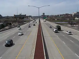 I‑235 crossing the Des Moines River in Des Moines, Iowa
 -
 The Edna M. Griffin Memorial Bridge carrying I‑235 across the Des Moines River
 -
-
 I‑280 crosses the Mississippi River over the Baker Bridge.
Business routes
| Number | Length (mi)[2] | Length (km) | Southern or western terminus | Northern or eastern terminus | Cities | Formed | Removed | |
|---|---|---|---|---|---|---|---|---|
| 6.927 | 11.148 | I-35 / US 30 in Ames | I-35 in Ames | Ames | 1995 | current | ||
| 2.979 | 4.794 | I-35 / US 18 in Clear Lake | I-35 / US 18 / Iowa 122 in Clear Lake | Clear Lake | 1999 | current | ||
References
- ^ Official Route Numbering for the National System of Interstate and Defense Highways (Map). American Association of State Highway Officials. August 14, 1957.
- ^ a b c "Road Network (Portal)" (ESRI shapefile). Ames: Iowa Department of Transportation. April 9, 2021. Retrieved April 19, 2021.
External links
Wikimedia Commons has media related to Interstate Highways in Iowa.
Template:Attached KML/List of Interstate Highways in Iowa
KML is from Wikidata
- The Iowa Highways Page by Jason Hancock
- Interstate Guide