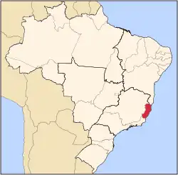
Itarana
Itarana | |
|---|---|
 | |
 Itarana Location in Brazil | |
| Coordinates: 19°52′26″S 40°52′30″W / 19.87389°S 40.87500°W | |
| Country | Brazil |
| Region | Southeast |
| State | Espírito Santo |
| Population (2020 [1]) | |
• Total | 10,494 |
| Time zone | UTC−3 (BRT) |
Itarana is a municipality located in the Brazilian state of Espírito Santo. Its population was 10,494 (2020) and its area is 296 km2.[2]
Geography
Climate
| Climate data for Itarana (1981–2010) | |||||||||||||
|---|---|---|---|---|---|---|---|---|---|---|---|---|---|
| Month | Jan | Feb | Mar | Apr | May | Jun | Jul | Aug | Sep | Oct | Nov | Dec | Year |
| Mean daily maximum °C (°F) | 32.3 (90.1) |
33.5 (92.3) |
32.8 (91.0) |
31.4 (88.5) |
29.6 (85.3) |
28.2 (82.8) |
28.0 (82.4) |
28.5 (83.3) |
29.3 (84.7) |
30.4 (86.7) |
30.4 (86.7) |
31.0 (87.8) |
30.5 (86.9) |
| Mean daily minimum °C (°F) | 21.6 (70.9) |
21.7 (71.1) |
21.3 (70.3) |
20.1 (68.2) |
17.8 (64.0) |
16.3 (61.3) |
15.8 (60.4) |
16.7 (62.1) |
18.4 (65.1) |
20.0 (68.0) |
20.8 (69.4) |
21.4 (70.5) |
19.3 (66.7) |
| Average precipitation mm (inches) | 123.0 (4.84) |
78.0 (3.07) |
103.0 (4.06) |
52.0 (2.05) |
24.0 (0.94) |
13.0 (0.51) |
11.0 (0.43) |
15.0 (0.59) |
29.0 (1.14) |
75.0 (2.95) |
166.0 (6.54) |
194.0 (7.64) |
883 (34.76) |
| Source 1: Instituto Nacional de Meteorologia[3] | |||||||||||||
| Source 2: Climatempo (precipitation)[4] | |||||||||||||
References
- ^ IBGE 2020
- ^ IBGE - [1]
- ^ "Normais Climatológicas Do Brasil 1981–2010" (in Portuguese). Instituto Nacional de Meteorologia. Retrieved 21 May 2024.
- ^ "Climatologia em Itarana, BR". Climatempo. Retrieved 25 May 2024.
