Jarvis Brook
| Jarvis Brook | |
|---|---|
| Village | |
St Michael and All Angels church | |
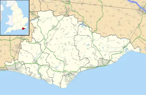
 Jarvis Brook Location within East Sussex | |
| Area | 2.6 km2 (1.0 sq mi) |
| Population | 4,305 |
| • Density | 1,826/sq mi (705/km2) |
| OS grid reference | TQ533300 |
| Civil parish | |
| District | |
| Shire county | |
| Region | |
| Country | England |
| Sovereign state | United Kingdom |
| Post town | CROWBOROUGH |
| Postcode district | TN6 |
| Dialling code | 01892 |
| Police | Sussex |
| Fire | East Sussex |
| Ambulance | South East Coast |
| UK Parliament | |
Jarvis Brook is a village in Crowborough parish in the Wealden district of East Sussex, England.[1] It lies in the south-east of the parish, about 1.5 miles (2.4 km) from Crowborough town centre.
In the 2021 Census, the electoral ward of the same name had a population of 4,305.[2]
Around the centre of the village are numerous individual businesses along Crowborough Hill, that acts as a high street and ends at Farningham Road. Crowborough railway station, on the Uckfield branch of the Oxted line, was historically known as Crowborough and Jarvis Brook and serves the village.[3]
To the south, Jarvis Brook has a church opened in 1876 called the Rethoboth Chapel.
History
Jarvis Brook grew up around the railway, with factories being built around the area. The Crowborough Country Park was a clay quarry that supplied the Crowborough brickworks until it closed in 1980. In 2009, it was turned into a local nature reserve.[4]
References
- ^ "Election Maps: Great Britain". Ordnance Survey. Retrieved 21 August 2025.
- ^ "Crowborough Jarvis Brook (Ward, United Kingdom) - Population Statistics, Charts, Map and Location". www.citypopulation.de. Retrieved 11 August 2025.
- ^ "Disused Stations: Crowborough & Jarvis Brook Station". www.disused-stations.org.uk. Retrieved 9 May 2025.
- ^ "Crowborough Country Park - Country Park in Crowborough, Crowborough - Wealden". www.explorewealden.co.uk. Retrieved 11 August 2025.