Jinzhou, Hebei
Jinzhou
晋州市 | |
|---|---|
.jpg) Jinzhou railway station | |
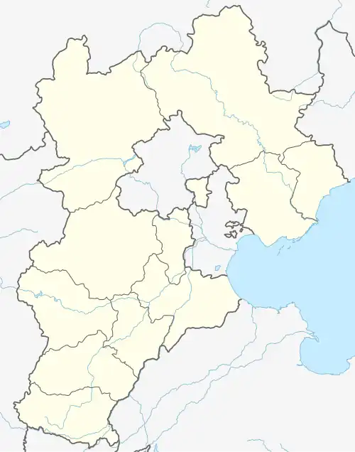 Jinzhou Location in Hebei | |
| Coordinates: 38°02′02″N 115°02′38″E / 38.034°N 115.044°E | |
| Country | People's Republic of China |
| Province | Hebei |
| Prefecture-level city | Shijiazhuang |
| Township-level divisions | 9 towns 1 township |
| Established | November 1991 |
| Municipal seat | Jinzhou, Jinzhou |
| Area | |
| 619.0 km2 (239.0 sq mi) | |
| • Urban | 90.78 km2 (35.05 sq mi) |
| Elevation | 47 m (155 ft) |
| Population (2017)[1] | |
| 582,000 | |
| • Density | 940/km2 (2,400/sq mi) |
| • Urban | 139,600 |
| Time zone | UTC+8 (China Standard) |
| Postal code | 052200 |
| Area code | 0311 |
| Website | jzchina |
Jinzhou (simplified Chinese: 晋州; traditional Chinese: 晉州; pinyin: Jìnzhōu; lit. 'Jin Prefecture') is a county-level city of Hebei Province, North China. It is under the administration of the prefecture-level city of Shijiazhuang, capital of Hebei. Until November 1991, it was known as Jin County (simplified Chinese: 晋县; traditional Chinese: 晉縣; pinyin: Jìn Xiàn).
Jinzhou is located in central Hebei province, 50 kilometres (31 mi) east of Shijiazhuang. It covers an area of 619 square kilometers, and as of 2010 census, has a population of about 537,700. It consists of nine towns and one township, as well as 224 villages.
Jinzhou has a recorded history of at least 2500 years. It was the hometown of Wei Zheng (魏征), a well-known and well-respected historical figure and official of early Tang dynasty. It is also, according to the Chinese government, the "duck pear town" (鸭梨之乡).
Administrative divisions
There are 9 towns and 1 township:[2]
- Jinzhou (晋州镇)
- Zongshizhuang (总十庄镇)
- Yingli (营里镇)
- Taoyuan (桃园镇)
- Dongzhuosu (东卓宿镇)
- Mayu (马于镇)
- Xiaoqiao (小樵镇)
- Huaishu (槐树镇)
- Donglizhuang (东里庄镇)
- Zhoujiazhuang Township (周家庄乡)
Climate
| Climate data for Jinzhou, elevation 42 m (138 ft), (1991–2020 normals, extremes 1981–2010) | |||||||||||||
|---|---|---|---|---|---|---|---|---|---|---|---|---|---|
| Month | Jan | Feb | Mar | Apr | May | Jun | Jul | Aug | Sep | Oct | Nov | Dec | Year |
| Record high °C (°F) | 16.8 (62.2) |
24.0 (75.2) |
32.2 (90.0) |
33.8 (92.8) |
39.0 (102.2) |
40.5 (104.9) |
42.6 (108.7) |
36.8 (98.2) |
36.1 (97.0) |
32.6 (90.7) |
26.3 (79.3) |
20.4 (68.7) |
42.6 (108.7) |
| Mean daily maximum °C (°F) | 3.4 (38.1) |
7.6 (45.7) |
14.7 (58.5) |
21.9 (71.4) |
27.6 (81.7) |
32.1 (89.8) |
32.4 (90.3) |
30.7 (87.3) |
27.0 (80.6) |
20.6 (69.1) |
11.4 (52.5) |
4.6 (40.3) |
19.5 (67.1) |
| Daily mean °C (°F) | −1.9 (28.6) |
1.7 (35.1) |
8.4 (47.1) |
15.5 (59.9) |
21.5 (70.7) |
26.2 (79.2) |
27.6 (81.7) |
26.1 (79.0) |
21.3 (70.3) |
14.6 (58.3) |
6.1 (43.0) |
−0.3 (31.5) |
13.9 (57.0) |
| Mean daily minimum °C (°F) | −6.0 (21.2) |
−2.7 (27.1) |
3.2 (37.8) |
9.8 (49.6) |
15.7 (60.3) |
20.8 (69.4) |
23.4 (74.1) |
22.2 (72.0) |
16.9 (62.4) |
9.9 (49.8) |
2.0 (35.6) |
−3.9 (25.0) |
9.3 (48.7) |
| Record low °C (°F) | −17.8 (0.0) |
−17.3 (0.9) |
−8.8 (16.2) |
−1.3 (29.7) |
4.2 (39.6) |
10.8 (51.4) |
16.7 (62.1) |
13.3 (55.9) |
6.0 (42.8) |
−3.8 (25.2) |
−15.7 (3.7) |
−22.8 (−9.0) |
−22.8 (−9.0) |
| Average precipitation mm (inches) | 2.0 (0.08) |
5.0 (0.20) |
8.7 (0.34) |
24.2 (0.95) |
33.4 (1.31) |
54.2 (2.13) |
114.9 (4.52) |
114.2 (4.50) |
44.6 (1.76) |
23.9 (0.94) |
13.3 (0.52) |
3.1 (0.12) |
441.5 (17.37) |
| Average precipitation days (≥ 0.1 mm) | 1.5 | 2.5 | 2.4 | 4.8 | 5.9 | 8.0 | 11.2 | 9.8 | 6.6 | 5.0 | 3.8 | 1.9 | 63.4 |
| Average snowy days | 2.6 | 2.4 | 1.0 | 0.2 | 0 | 0 | 0 | 0 | 0 | 0 | 1.3 | 2.2 | 9.7 |
| Average relative humidity (%) | 54 | 50 | 48 | 53 | 57 | 59 | 72 | 76 | 70 | 64 | 64 | 59 | 61 |
| Mean monthly sunshine hours | 152.3 | 162.8 | 213.6 | 229.2 | 253.5 | 221.8 | 182.5 | 193.4 | 190.3 | 176.2 | 150.6 | 148.3 | 2,274.5 |
| Percentage possible sunshine | 50 | 53 | 57 | 58 | 57 | 50 | 41 | 46 | 52 | 51 | 50 | 50 | 51 |
| Source: China Meteorological Administration[3][4] | |||||||||||||
Transport
- G1811 Huanghua–Shijiazhuang Expressway
- China National Highway 307
- Shijiazhuang–Dezhou Railroad
References
- ^ a b Ministry of Housing and Urban-Rural Development, ed. (2019). China Urban Construction Statistical Yearbook 2017. Beijing: China Statistics Press. p. 46. Archived from the original on 18 June 2019. Retrieved 11 January 2020.
- ^ 2011年统计用区划代码和城乡划分代码:晋州市 (in Chinese). National Bureau of Statistics of the People's Republic of China. Retrieved 2013-01-19.
- ^ 中国气象数据网 – WeatherBk Data (in Simplified Chinese). China Meteorological Administration. Retrieved 25 August 2023.
- ^ 中国气象数据网 (in Simplified Chinese). China Meteorological Administration. Retrieved 25 August 2023.
External links
- 晋州市人民政府 (Jinzhou Municipal Government) Archived 2006-01-06 at the Wayback Machine (in Simplified Chinese)
- 晋州招商网 (Jinzhou Trade Website) (in Simplified Chinese)