Kävlinge River
| Kävlinge River Lödde å | |
|---|---|
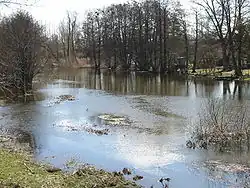 Kävlinge River near Gårdstånga | |
| Native name | Kävlingeån (Swedish) |
| Location | |
| Country | Sweden |
| County | Skåne |
| Physical characteristics | |
| Source | Vombsjön |
| • coordinates | 55°41′54″N 13°33′19″E / 55.69833°N 13.55528°E |
| • elevation | 19 m (62 ft) |
| Mouth | Lommabukten in Öresund |
• coordinates | 55°43′45″N 12°59′45″E / 55.72917°N 12.99583°E |
• elevation | 0 m (0 ft) |
| Length | 90 km (56 mi)[1] |
| Basin size | 1,203.8 km2 (464.8 sq mi)[2] |
Kävlinge River (Kävlingeån in Swedish, but also known as Lödde å between the town of Kävlinge and the mouth near Löddeköpinge) is the name of a small river on the flat lands of Scania in southern Sweden.
It starts at the lake Vombsjön and ends in the Öresund strait.[1] The river is only 50 km long but played an important role in the Battle of Lund in 1676.
References
- ^ a b "Kävlingeån". Nationalencyklopedin (in Swedish). Retrieved 14 July 2010. (subscription required)
- ^ "Län och huvudavrinningsområden i Sverige" (PDF) (in Swedish). Swedish Meteorological and Hydrological Institute. Archived from the original (PDF) on 28 September 2018. Retrieved 14 July 2010.