Křešín (Pelhřimov District)
Křešín | |
|---|---|
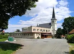 Restaurant and Church of Saint Bartholomew | |
 Křešín Location in the Czech Republic | |
| Coordinates: 49°34′54″N 15°2′38″E / 49.58167°N 15.04389°E | |
| Country | |
| Region | Vysočina |
| District | Pelhřimov |
| First mentioned | 1318 |
| Area | |
• Total | 11.10 km2 (4.29 sq mi) |
| Elevation | 512 m (1,680 ft) |
| Population (2025-01-01)[1] | |
• Total | 184 |
| • Density | 17/km2 (43/sq mi) |
| Time zone | UTC+1 (CET) |
| • Summer (DST) | UTC+2 (CEST) |
| Postal codes | 394 24, 395 01 |
| Website | www |
Křešín is a municipality and village in Pelhřimov District in the Vysočina Region of the Czech Republic. It has about 200 inhabitants.
Křešín lies approximately 22 kilometres (14 mi) north-west of Pelhřimov, 45 km (28 mi) north-west of Jihlava, and 72 km (45 mi) south-east of Prague.
Administrative division
Křešín consists of five municipal parts (in brackets population according to the 2021 census):[2]
- Křešín (80)
- Blažnov (15)
- Čeněnice (7)
- Kramolín (14)
- Mohelnice (44)
Demographics
| Year | Pop. | ±% |
|---|---|---|
| 1869 | 908 | — |
| 1880 | 913 | +0.6% |
| 1890 | 821 | −10.1% |
| 1900 | 745 | −9.3% |
| 1910 | 800 | +7.4% |
| 1921 | 812 | +1.5% |
| 1930 | 727 | −10.5% |
| 1950 | 470 | −35.4% |
| 1961 | 451 | −4.0% |
| 1970 | 360 | −20.2% |
| 1980 | 282 | −21.7% |
| 1991 | 203 | −28.0% |
| 2001 | 166 | −18.2% |
| 2011 | 138 | −16.9% |
| 2021 | 160 | +15.9% |
| Source: Censuses[3][4] | ||
References
- ^ "Population of Municipalities – 1 January 2025". Czech Statistical Office. 2025-05-16.
- ^ "Public Census 2021 – basic data". Public Database (in Czech). Czech Statistical Office. 2022.
- ^ "Historický lexikon obcí České republiky 1869–2011" (in Czech). Czech Statistical Office. 2015-12-21.
- ^ "Population Census 2021: Population by sex". Public Database. Czech Statistical Office. 2021-03-27.
External links
Wikimedia Commons has media related to Křešín (Pelhřimov District).