Křimov
Křimov | |
|---|---|
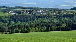 View from the northwest | |
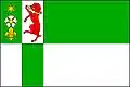 Flag 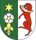 Coat of arms | |
 Křimov Location in the Czech Republic | |
| Coordinates: 50°29′10″N 13°18′6″E / 50.48611°N 13.30167°E | |
| Country | |
| Region | Ústí nad Labem |
| District | Chomutov |
| First mentioned | 1281 |
| Area | |
• Total | 30.33 km2 (11.71 sq mi) |
| Elevation | 725 m (2,379 ft) |
| Population (2025-01-01)[1] | |
• Total | 435 |
| • Density | 14/km2 (37/sq mi) |
| Time zone | UTC+1 (CET) |
| • Summer (DST) | UTC+2 (CEST) |
| Postal code | 430 01 |
| Website | www |
Křimov (German: Krima) is a municipality and village in Chomutov District in the Ústí nad Labem Region of the Czech Republic. It has about 400 inhabitants.
Křimov lies approximately 8 kilometres (5 mi) west of Chomutov, 57 km (35 mi) west of Ústí nad Labem, and 92 km (57 mi) north-west of Prague.
Administrative division
Křimov consists of nine municipal parts (in brackets population according to the 2021 census):[2]
- Křimov (149)
- Celná (14)
- Domina (36)
- Krásná Lípa (82)
- Menhartice (0)
- Nebovazy (3)
- Stráž (4)
- Strážky (51)
- Suchdol (43)
Demographics
| Year | Pop. | ±% |
|---|---|---|
| 1869 | 1,711 | — |
| 1880 | 1,683 | −1.6% |
| 1890 | 1,705 | +1.3% |
| 1900 | 1,575 | −7.6% |
| 1910 | 1,506 | −4.4% |
| 1921 | 1,484 | −1.5% |
| 1930 | 1,588 | +7.0% |
| 1950 | 468 | −70.5% |
| 1961 | 402 | −14.1% |
| 1970 | 322 | −19.9% |
| 1980 | 199 | −38.2% |
| 1991 | 99 | −50.3% |
| 2001 | 152 | +53.5% |
| 2011 | 312 | +105.3% |
| 2021 | 382 | +22.4% |
| Source: Censuses[3][4] | ||
References
- ^ "Population of Municipalities – 1 January 2025". Czech Statistical Office. 2025-05-16.
- ^ "Public Census 2021 – basic data". Public Database (in Czech). Czech Statistical Office. 2022.
- ^ "Historický lexikon obcí České republiky 1869–2011" (in Czech). Czech Statistical Office. 2015-12-21.
- ^ "Population Census 2021: Population by sex". Public Database. Czech Statistical Office. 2021-03-27.
External links
Wikimedia Commons has media related to Křimov.