Kanchanpur, Rohtas
Kanchanpur | |
|---|---|
village | |
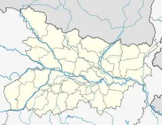 Kanchanpur Location in Bihar, India  Kanchanpur Kanchanpur (India) | |
| Coordinates: 24°48′0″N 84°15′0″E / 24.80000°N 84.25000°E | |
| Country | |
| State | Bihar |
| District | Rohtas |
| Area | |
• Total | 4.8 km2 (1.9 sq mi) |
| Elevation | 110 m (360 ft) |
| Population (2011) | |
• Total | 2,865 |
| • Density | 600/km2 (1,500/sq mi) |
| Languages | |
| • Official | Bhojpuri Language, Hindi |
| Time zone | UTC+5:30 (IST) |
| PIN | 821305 |
| ISO 3166 code | IN-BR |
| National Highway 2](WestBengal To Delhi) city | sasaram |
| Literacy | 95% |
| Lok Sabha constituency | sasaram |
| Vidhan Sabha constituency | sasaram |
Kanchanpur is a small village located in Rohtas district, Bihar state, India. It is near the National Highway 2. As of the year 2011, it had a total population of 2,865.[1]
Geography
Kanchanpur is situated on the south of Indrapuri Barrange Canal, about 36 kilometres southeast of the district seat Sasaram. It covers a total area of 480 hectares.[2]
References
- ^ "Population finder 2011". Office of the Registrar General & Census Commissioner, India. Retrieved 25 October 2023.
- ^ Census of India 2011 Bihar District Census Handbook Rohtas (PDF). Directorate of Census Operations, Bihar. p. 1044. Retrieved 25 October 2023.