Kapandriti
Kapandriti
Καπανδρίτι | |
|---|---|
 Kapandriti Location within the regional unit 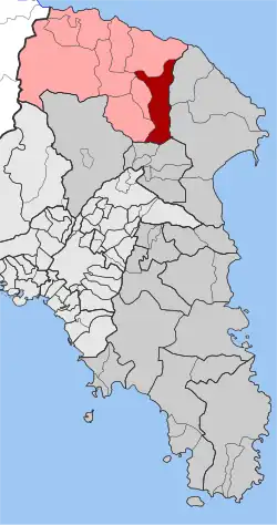 | |
| Coordinates: 38°13′N 23°53′E / 38.217°N 23.883°E | |
| Country | Greece |
| Administrative region | Attica |
| Regional unit | East Attica |
| Municipality | Oropos |
| Area | |
| • Municipal unit | 36.789 km2 (14.204 sq mi) |
| Elevation | 356 m (1,168 ft) |
| Population (2021)[1] | |
| • Municipal unit | 3,534 |
| • Municipal unit density | 96/km2 (250/sq mi) |
| Time zone | UTC+2 (EET) |
| • Summer (DST) | UTC+3 (EEST) |
| Postal code | 190 14 |
| Area code(s) | 22950 |
| Vehicle registration | Z |
Kapandriti (Greek: Καπανδρίτι) is a town in the north of East Attica in Greece. Since the 2011 local government reform it is part of the municipality Oropos, of which it is a municipal unit.[2] The municipal unit has an area of 36.789 square kilometres (14.204 sq mi).[3][4]
Historical population
Kapandriti has historically been an Arvanite settlement.[5]
See also
References
- ^ "Αποτελέσματα Απογραφής Πληθυσμού - Κατοικιών 2021, Μόνιμος Πληθυσμός κατά οικισμό" [Results of the 2021 Population - Housing Census, Permanent population by settlement] (in Greek). Hellenic Statistical Authority. 29 March 2024.
- ^ "ΦΕΚ B 1292/2010, Kallikratis reform municipalities" (in Greek). Government Gazette.
- ^ "Population & housing census 2001 (incl. area and average elevation)" (PDF) (in Greek). National Statistical Service of Greece. Archived from the original (PDF) on 2015-09-21.
- ^ "Athens Population 2021 (Demographics, Maps, Graphs)".
- ^ Hans-Jürgen Sasse (1991). Arvanitika: die albanischen Sprachreste in Griechenland. Vol. 1. p. 18. ISBN 9783447027588.